
Via Lattea
Via Lattea: Europe's mega ski area with 400km slopes across Italy-France. Sestriere to Montgenèvre from €52, kids under 6 free.
Season 2026 - 2027
Opens
28 Nov 2026
Closes
18 Apr 2027
Days open
141
Annual snow
4m
The Overview
Michael Fulton
Melbourne-based skier and snowboarder with 50+ resorts across 5 continents. Specialises in Australian resorts and international resort comparisons.
Via Lattea delivers Europe's most expansive cross-border skiing experience across 400km of interconnected terrain spanning Italy and France, linking seven distinct resorts through a sophisticated lift network. This massive ski domain reaches 2,789m elevation at Mont Motta in Sestriere, connecting the Italian resorts of Sestriere, Sauze d'Oulx, Sansicario, Cesana, Claviere, and Pragelato with France's Montgenèvre across the border. The terrain distribution of 24% beginner, 55% intermediate, and 21% advanced runs across 312 trails creates exceptional variety for all abilities whilst maintaining the famous Olympic heritage from the 2006 Turin Winter Games held throughout the region.
The resort's elevation range between 1,538m and 2,789m ensures reliable snow conditions supplemented by comprehensive snowmaking across 120km of terrain. The predominantly north-facing slopes preserve excellent snow quality throughout the season, with the high-altitude zones in Sestriere and Montgenèvre providing particularly consistent conditions. The interconnected nature allows skiers to traverse between distinctly different resort atmospheres, from purpose-built Sestriere's modern infrastructure to traditional Claviere's authentic mountain village character, all on a single lift pass.
Via Lattea represents exceptional value amongst major European ski areas, with daily lift tickets from €52 offering access to terrain comparable to far more expensive French mega-resorts. The cross-border configuration creates unique opportunities to experience both Italian and French alpine cultures, cuisines, and skiing styles within a single holiday, whilst the sheer scale of 400km ensures fresh terrain exploration throughout extended stays.
1251m
Vertical
312
Runs
400 km
Piste
4m
Annual snow
The Terrain
312 runs across 400 km of piste
Via Lattea is one of the largest linked ski areas in Italy, with 312 runs and 400 kilometres of piste between 1,538 metres and 2,789 metres, a vertical of 1,251 metres. The grading is 24% beginner, 55% intermediate and 21% advanced, with no expert-rated runs. That gives confident intermediates plenty of mileage and leaves a solid share of steeper pistes for stronger skiers. The network runs to 69 lifts, including 28 quad chairs, three eight-seaters, two six-seaters, two gondolas, one aerial tram and 19 T-bars, so plan each day around a sector or two.
The area links Sestriere, Sauze d'Oulx, Sansicario, Claviere and Pragelato, then crosses the border to Montgenèvre in France. Sestriere was built by Giovanni Agnelli in the 1930s and holds the steeper, north-facing pistes. Sansicario hosted the women's speed events on the Fraiteve piste at the 2006 Winter Olympics, and Sestriere staged racing as well. Sauze d'Oulx has wide, tree-lined reds that give shelter when the weather closes in. Via Lattea suits intermediates chasing big days across two countries, and advanced skiers will find enough to stay busy. Expect some long traverses between sectors.
Terrain split
312
runs
312 runs across 4 grades
Beginner75 runs · 24%
Intermediate172 runs · 55%
Advanced66 runs · 21%
Expert0 runs · 0%
Time it right
When to visit Via Lattea
Via Lattea typically operates from late November through late April, with peak conditions occurring January through March when the Piedmont Alps receive substantial natural snowfall averaging 3.5m annually. The elevation range between 1,538m and 2,789m provides sufficient altitude for reliable natural snow preservation across upper zones, supplemented by comprehensive snowmaking across 120km ensuring base area coverage throughout winter. The extended season length reflects the high-altitude infrastructure and north-facing slope orientations preserving snow quality into spring.
The predominantly north-facing aspects across Sestriere, Sansicario, and upper Montgenèvre zones maintain excellent snow preservation throughout winter, whilst lower villages like Cesana occasionally struggle during warm periods. The 2006 Olympic legacy includes world-class grooming standards with extensive snow grooming fleets maintaining immaculate piste conditions across the interconnected network. Weekend and Italian holiday periods attract substantial visitor numbers from Turin, Milan, and Genoa, though the massive terrain distribution prevents congestion affecting skiing quality.
Spring skiing extends reliably through April with pleasant temperatures and softening snow creating enjoyable recreational conditions across higher elevations. The cross-border configuration creates microclimate variations, with French-facing Montgenèvre occasionally receiving different weather patterns than Italian sectors. The sheer scale ensures fresh powder stashes remain discoverable days after storms across the 400km network, particularly in less-travelled intermediate zones connecting resort villages.
Season 2026 - 2027
28 Nov 2026
Opens
18 Apr 2027
Closes
141
Days open
4 m
Annual snow
Getting there
Getting to Via Lattea, and where to stay
Situated in Piedmont's Cottian Alps approximately 90km west of Turin, Via Lattea occupies strategic positioning with exceptional accessibility from northern Italy's major population centres and international airports. Turin-Caselle Airport lies 90km east with transfer times around 90 minutes via the E70 motorway to Oulx, whilst Milan Malpensa 240km southeast provides alternative international connections with 3-hour transfers. Chambéry Airport 137km northwest offers French gateway access, with Geneva 200km north positioning Via Lattea as a weekend destination for multiple European cities.
The historic transport hub of Oulx serves as the geographical centrepiece, with rail connections on the Paris-Turin TGV line providing direct train access eliminating road transfers. The railway station at Oulx sits just 6km from Sauze d'Oulx lifts with regular shuttle bus connections, whilst Briançon station 12km from Montgenèvre serves the French sector. This exceptional rail connectivity distinguishes Via Lattea from many Italian resorts, with the Paris Gare de Lyon to Oulx journey requiring just 5 hours on direct TGV services.
The seven resort villages provide diverse accommodation options spanning purpose-built Sestriere at 2,035m elevation through traditional mountain communities like Claviere at 1,760m and valley town Cesana at 1,354m. The cross-border configuration creates distinctive cultural atmospheres, with Italian sectors offering authentic Piedmontese cuisine and hospitality whilst French Montgenèvre delivers traditional Savoyard alpine character. The Fréjus Tunnel connection provides convenient access from western France and Switzerland, positioning Via Lattea as a natural stopover for multi-resort alpine touring holidays.
Where to stay
Search all stays →Hotels and lodges near Via Lattea, powered by Stay22.
Latest News
From the SnowStash desk

Europe Ski Resorts Open Now: What Is Skiable in Mid-October 2026
Europe’s ski season is open, technically. After a record-warm summer, glaciers in Austria, Switzerland and Italy are running a few pistes apiece, Sölden, Stubai and Kitzsteinhorn started late, Titlis has pushed back to 24 October, and Zermatt reopens a few lifts on 14 October after more than two months shut. Finland’s Levi and Ruka are skiing on stored snow. Here is what is open, and what you actually get at each.
14 Oct 2026

Zermatt Plans World Cup Downhill Return on the Gornergrat for 2028
Zermatt is having another crack at a World Cup downhill, and this time nobody has to cross a border. Around 13 million Swiss francs is going into rebuilding the Gornergrat piste, including a jump fed by a roughly 300-metre in-run across the roof of the Gornergrat Railway gallery, with the Matterhorn lined up behind it for the TV cameras. First men’s race is pencilled in for March 2028, pending FIS homologation.
14 Oct 2026

Mt. Rose Begins Snowmaking for the 2026-27 Season at Lake Tahoe
Lake Tahoe’s highest base elevation is paying off early: Mt. Rose has started making snow for 2026-27 after the first flurries and a cold snap. The Nevada resort is backing it with nearly US$2 million in upgrades, including a replacement snowmaking main line, a new PistenBully groomer and restraint bars on every lift. Opening day is yet to be confirmed, though Heavenly and Northstar are already eyeing 20 November.
13 Oct 2026

Utah Ski Resorts 2026-27: What’s New at Alta, Deer Valley, Powder Mountain and More
Utah is still building flat out. For 2026-27, Powder Mountain opens a steep new Skytrac chair into more than 1,000 acres of advanced terrain, Deer Valley adds 200 acres on Hail Peak, Sundance gets a new quad and Park City adds a gondola from its new parking structure. Snowmaking is expanding almost everywhere, Eagle Point stays closed after the Cottonwood Fire, and the 2034 Games are setting the pace. Here’s what’s new, resort by resort.
13 Oct 2026

Mt Hutt Invests NZ$12 Million in Base Area, Tripling Its Sun Deck
Mt Hutt is getting busier, and its base lodge is about to catch up. NZ$12 million goes into a heated sun deck roughly three times the current size (430 m² to 1,300 m²), plus a new toilet block, heated steps down to snow level, extra storage and a new food and beverage outlet. Building starts after the 2026 season, with everything due for winter 2027.
11 Oct 2026

Vermont Ski Resort Opening Dates 2026-27: Few Dates Set, Killington Waits on the Cold
Vermont's season is slow to take shape. Stratton is tentatively targeting 18 November and Sugarbush 21 November, while Pico has Friday 11 December on the calendar. Killington never sets a date and opens when the snowmaking allows, and Vail Resorts has yet to name days for Stowe, Okemo and Mount Snow. The forecasts disagree about snow, and the main El Niño worry for the Green Mountains is warmth.
9 Oct 2026
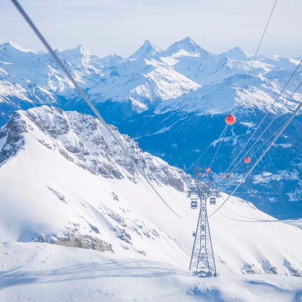
Crans-Montana 2027 World Championships President Resigns Ahead of Fraud Hearing
Less than four months out from the Crans-Montana 2027 World Championships, the man running the organising committee has stepped down. Claude-Alain Schmidhalter resigned as Swiss-Ski vice president and OC president after being indicted over a business dispute unrelated to skiing. He denies the allegations and faces court on October 27. Interim leaders are in place for the February 1-14 event.
9 Oct 2026
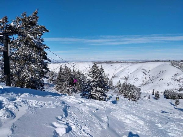
Kelly Canyon, Idaho, Adds Snowmaking, a Bigger Terrain Park and More Parking for 2026-27
Kelly Canyon had a rough 2025-26, and the Idaho resort has spent the summer making sure it doesn’t repeat. Snowmaking now reaches the top of Goldrush, the terrain park is doubling in size with a stereo system, lights and a snack shack, and the car park is getting bigger. Grooming is stepping up too. Target opening is December 4, conditions permitting.
9 Oct 2026