
Lauchernalp
Lauchernalp: 1,688m vertical, 3,111m summit, 40km piste. Magic Pass access in UNESCO World Heritage setting, Valais.
Season 2026 - 2027
Opens
12 Dec 2026
Closes
11 Apr 2027
Days open
120
Annual snow
4m
The Overview
Michael Fulton
Melbourne-based skier and snowboarder with 50+ resorts across 5 continents. Specialises in Australian resorts and international resort comparisons.
The ski area spans 1,403 to 3,111 metres elevation across 40 kilometres of piste, dividing 12 marked runs over 1,688 vertical metres. Terrain splits 45 per cent beginner, 35 per cent intermediate and 20 per cent advanced, with off-piste terrain between prepared runs attracting freeriders. The Hockenhorngrat summit at 3,111 metres delivers views across 40 peaks above 4,000 metres in the UNESCO Jungfrau-Aletsch World Heritage Site. Average annual snowfall reaches 4.3 metres, whilst the elevation spread and predominantly north-facing aspect ensure reliable coverage from December through April.
The upper slopes between Stafel at 2,100 metres and Gandegg at 2,720 metres offer wide, varied terrain for progression, with blue runs occupying both lower and upper sectors. Four black pistes totalling 18 kilometres challenge experts, whilst five intermediate runs traverse the full vertical. The Stägäru descent from Gandegg provides an entry point for skiers attempting their first black run. Natural halfpipes and accessible sidecountry terrain extend options beyond the marked 40 kilometres, with routes to Kippel village offering alternative descents for confident skiers.
Lauchernalp sits on a sunny terrace between 1,900 and 2,100 metres above the Lötschental, accessed via cable car from Wiler village. The compact base area centres on mountain huts and the Panorama Restaurant Zudili at the main facilities. Weekend crowds increase when Magic Pass holders arrive from regional centres, though weekday skiing remains quiet. The isolated location and traditional valley character contrast with larger Valais resorts, creating an atmosphere that prioritises terrain quality over extensive amenities.
Magic Pass coverage from CHF 459 provides access alongside 69 other Swiss destinations, replacing individual season tickets from 2023. Daily rates range from CHF 54 to CHF 62 for adults, with dynamic pricing rewarding advance purchase. The 2025-26 season runs 14 December to 21 April, slightly shorter than major neighbours. Lauchernalp suits intermediates seeking varied terrain, freeriders prioritising accessible off-piste, and families requiring manageable elevations, though limited run count may restrict week-long visits without combining nearby resorts.
1688m
Vertical
12
Runs
40 km
Piste
4m
Annual snow
The Terrain
12 runs across 40 km of piste
Lauchernalp is a compact Lötschental ski area with 12 runs over 40 kilometres, falling 1,688 metres from 3,091 metres to a village base at 1,403 metres. The mix is 45% beginner, 35% intermediate and 20% advanced, with nothing graded expert. Only six lifts are needed: an aerial tram, a gondola, a six-seat chair, a triple chair, a T-bar and a surface lift. The sunny terrace above the valley stays quiet outside holiday weeks, which makes it an easy place to get laps in without queuing, even on a Saturday.
The glacier cable car climbs toward the Hockenhorn ridge and opens the high terrain above the village, while the Stafel-Gandegg chairlift gives access to the widest spread of ungroomed, rocky off-piste around its two pistes. Freeriders can look further afield, since the Lötschental is known for ski touring and backcountry routes that demand proper avalanche gear and local knowledge. Families and relaxed intermediates suit the groomed side of the mountain, while confident off-piste skiers can treat it as a quiet alternative to the bigger Valais names.
Terrain split
12
runs
12 runs across 4 grades
Beginner5 runs · 45%
Intermediate4 runs · 35%
Advanced2 runs · 20%
Expert0 runs · 0%
Time it right
When to visit Lauchernalp
The 2025-26 season operates 14 December 2025 to 21 April 2026, spanning 128 days with possible pre-season opening 6-8 December if snowfall permits. The 2026-27 season opens 12 December 2026 and closes 11 April 2027. Typical operations run mid-December through mid-April, with late November and late April dates depending on conditions. Operating hours maintain consistency through the season, with the cable car beginning at 07:15 and lifts operating until 16:35 daily.
Average annual snowfall totals 4.3 metres, with the highest accumulation occurring January through March. The elevation advantage and predominantly north-facing slopes preserve snow quality weeks after storms, often maintaining excellent conditions when lower valleys struggle. Current base depth sits at 299 centimetres at 3,111 metres, with 52 centimetres falling in the past week and 418 centimetres season total. Minimal snowmaking supplements natural precipitation, though the high base elevation at 1,403 metres and summit at 3,111 metres provide inherent reliability.
January through March delivers optimal powder skiing, with February historically receiving the heaviest snowfall. Week 2 of January averages 51 centimetres across 3.8 snowy days, representing peak accumulation periods. Spring skiing extends through April on upper slopes, with the Hockenhorngrat gondola accessing terrain above 2,700 metres where coverage persists. December and early January conditions vary annually depending on early-season storms, whilst late March brings increasing sunshine and stable snow on north aspects.
No major events calendar disrupts the quiet season character, though traditional Lötschental carnival features Tschäggättä masked figures in February. Night skiing does not operate given the cable car-dependent access and remote location. Summer operations run the Wiler-Lauchernalp cable car and Lauchernalp-Stafel chairlift weekends from late May through early November, with daily service mid-July through mid-August for hiking access.
Season 2026 - 2027
12 Dec 2026
Opens
11 Apr 2027
Closes
120
Days open
4 m
Annual snow
Getting there
Getting to Lauchernalp, and where to stay
Lauchernalp occupies the southern slopes of the Lötschental, the largest valley on the northern side of the Rhône Valley in Valais canton. The valley extends 27 kilometres from the Lötschenlücke glacier at 3,178 metres to Gampel-Steg at 630 metres, enclosed by peaks including the Bietschhorn at 3,934 metres. Wiler village at 1,419 metres serves as the cable car base, whilst the ski area plateau sits between 1,900 and 2,100 metres. The UNESCO Jungfrau-Aletsch Protected Area borders the valley's eastern edge, declared a Natural World Heritage Site in 2001.
Wiler lies 0.5 kilometres from the resort base, with Kippel at 0.6 kilometres and Ferden at 1.9 kilometres forming the valley's primary settlements. The four villages total approximately 1,500 inhabitants across the isolated valley. Blatten village at the valley head suffered complete burial in a May 2025 landslide, reducing accommodation options. Brig sits 25 minutes south via Goppenstein, whilst the valley's position north of the main Rhône corridor creates distinct separation from through-traffic routes.
Road access from the south follows the Rhône Valley motorway A9 to Gampel-Steg, then a narrow mountain road through Goppenstein and the valley villages. Driving from the north requires the Lötschberg car shuttle train from Kandersteg to Goppenstein, a 15-minute rail journey departing every 30 minutes. The shuttle costs approximately CHF 27 per vehicle, avoiding the lengthy drive via mountain passes. From Goppenstein station, the valley road runs 5 kilometres to Wiler through Ferden and Kippel, with sections narrowing through village centres requiring careful navigation.
Bern Airport sits 79 kilometres distant with 1 hour 38 minutes driving time, though international connections favour Zurich Airport at 207 kilometres or Geneva at 204 kilometres. Goppenstein railway station provides the practical access point, served hourly by RegioExpress trains on the Bern-Lötschberg-Simplon line. Journey time from Bern reaches 1.5 hours, from Zurich 2.5 hours and from Brig 25 minutes. PostBus route 591 meets arriving trains, connecting Goppenstein to Wiler cable car base in 10 minutes with service coordinated to rail schedules.
Where to stay
Search all stays →Hotels and lodges near Lauchernalp, powered by Stay22.
Latest News
From the SnowStash desk

Vermont Ski Resort Opening Dates 2026-27: Few Dates Set, Killington Waits on the Cold
Vermont's season is slow to take shape. Stratton is tentatively targeting 18 November and Sugarbush 21 November, while Pico has Friday 11 December on the calendar. Killington never sets a date and opens when the snowmaking allows, and Vail Resorts has yet to name days for Stowe, Okemo and Mount Snow. The forecasts disagree about snow, and the main El Niño worry for the Green Mountains is warmth.
9 Oct 2026
Crans-Montana 2027 World Championships President Resigns Ahead of Fraud Hearing
Less than four months out from the Crans-Montana 2027 World Championships, the man running the organising committee has stepped down. Claude-Alain Schmidhalter resigned as Swiss-Ski vice president and OC president after being indicted over a business dispute unrelated to skiing. He denies the allegations and faces court on October 27. Interim leaders are in place for the February 1-14 event.
9 Oct 2026
Kelly Canyon, Idaho, Adds Snowmaking, a Bigger Terrain Park and More Parking for 2026-27
Kelly Canyon had a rough 2025-26, and the Idaho resort has spent the summer making sure it doesn’t repeat. Snowmaking now reaches the top of Goldrush, the terrain park is doubling in size with a stereo system, lights and a snack shack, and the car park is getting bigger. Grooming is stepping up too. Target opening is December 4, conditions permitting.
9 Oct 2026
Valle Nevado Extends Season to November 8 After 108 cm in 48 Hours
Winter was meant to be winding down in Chile. Then Valle Nevado took 108 cm in 48 hours in early October, and the resort has pushed its closing date out to November 8 - its latest in 38 years of operation. That makes 143 days of skiing since opening day on June 19, with 690 cm banked for the season. Only part of the mountain is running while the storm settles, so check the mountain report before you plan a trip.
9 Oct 2026
Alps Snow Forecast: Cold Front Brings Thursday Snow to the High Alps
The Alps look a lot more like winter today, for a day or so. A cold front is moving west to east, dropping up to 35 cm on high glaciers and peaks, with snow levels falling to around 1,500-1,800 m at times. Don’t plan a trip around it: mid-elevation snow will be thin and wet, every area is closed bar a limited Sölden glacier opening tomorrow, and warmer weather returns by Monday.
8 Oct 2026
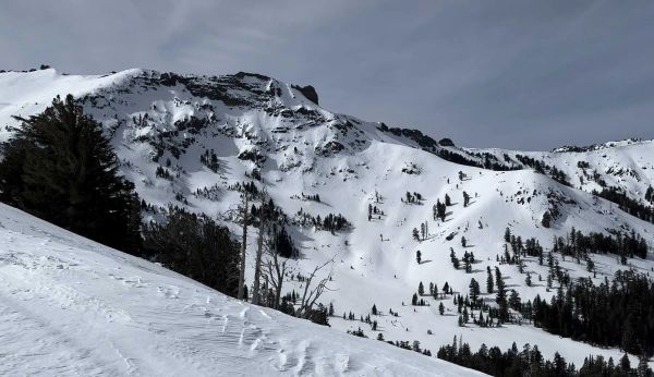
California Ski Resort Opening Dates 2026-27: Mammoth Leads, Tahoe Follows
Mammoth Mountain is first up in California, targeting Friday 13 November after a dusting of September snow. Heavenly and Northstar follow on 20 November, Palisades Tahoe on Wednesday 25 November and Sugar Bowl on 27 November, with Kirkwood on 4 December and June Mountain on 19 December. Plenty of smaller areas have no date yet. A super El Niño favours the Sierra, but a warmer storm track is the catch.
7 Oct 2026
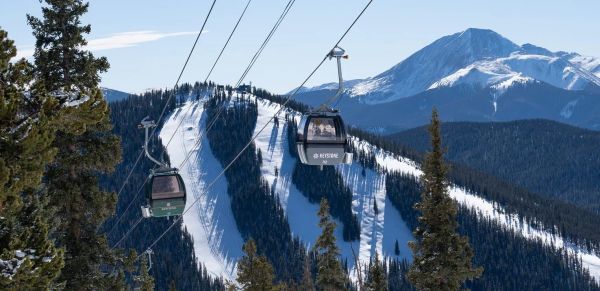
Colorado Ski Resort Opening Dates 2026-27: A-Basin and Keystone Race to Be First
Arapahoe Basin, Keystone and Winter Park are all chasing an October start, though none has a firm date yet. The first dated openers are Breckenridge and Copper on Friday 6 November, then Vail on 13 November, with most of the rest bunched around US Thanksgiving. Hesperus did not open at all last season. A super El Niño offers hope but no guarantee, and forecasters say the southern mountains have the better odds.
5 Oct 2026
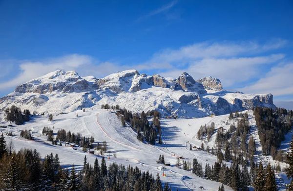
Dolomiti Superski 2026-27: Four New Gondolas, New Reservoirs and an €89 Peak Day Pass
Dolomiti Superski is spending around €100 million across its 12 areas before winter. Kronplatz gets a new 10-passenger gondola with a middle station, 3 Zinnen gets Helmissimo, and Val di Fassa swaps a chairlift for a gondola above Col Valvacin. New water-storage basins and upgraded snowmaking follow, and construction has started on the San Martino to Passo Rolle link. A peak adult day pass is €89.
4 Oct 2026