TL;DR
A modest cold front will deliver snow to high-altitude European resorts from Monday through Thursday, with the western and southern Alps favoured. Val Thorens and Cervinia could see up to 30cm, while many Austrian resorts miss out entirely. Snow levels fluctuate between 1,800-2,400 metres.
Western Alps Set for Mid-Week Snow While Austria Stays Dry
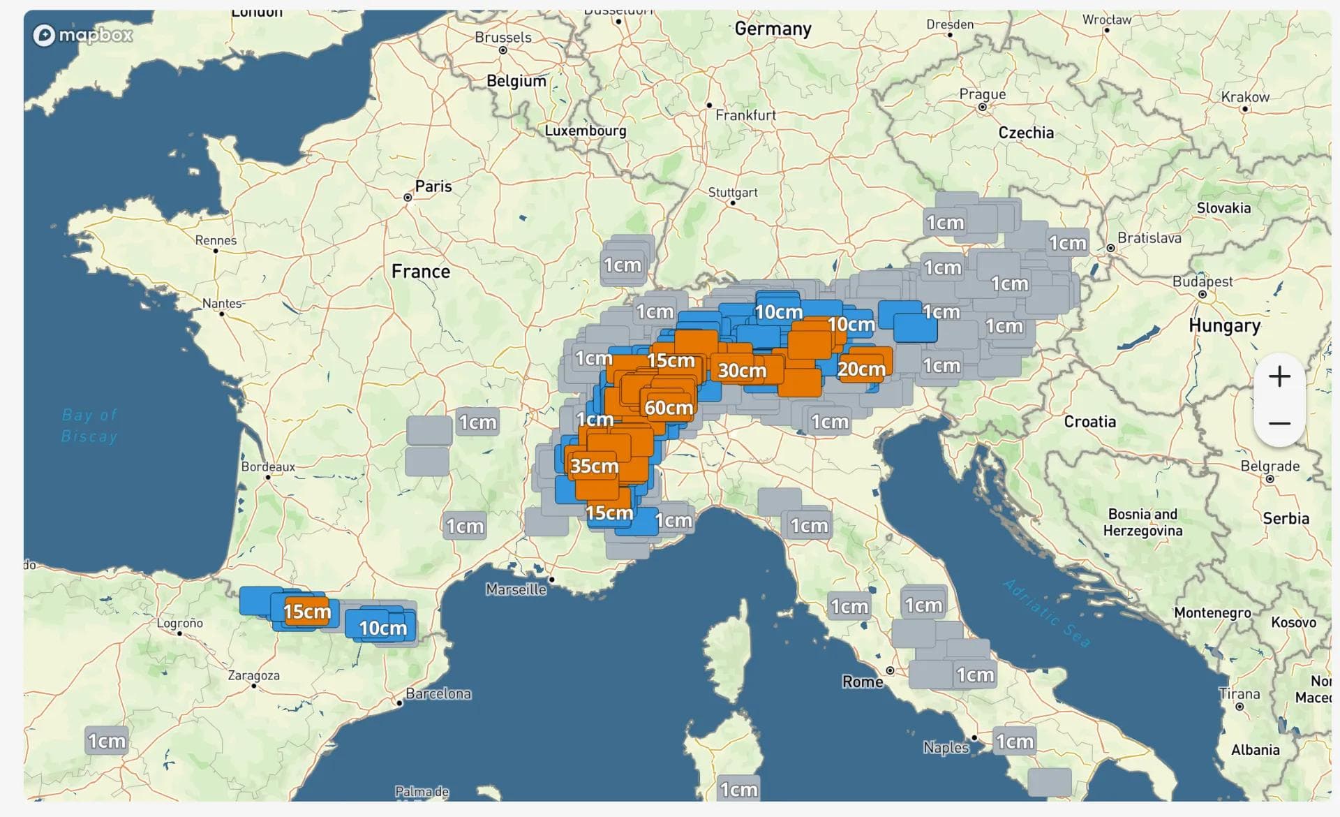
A cold front moving through the European Alps from Monday through Thursday will deliver the most significant snowfall to high-altitude French and Italian resorts, with totals between 20-30cm possible at Val Thorens and Cervinia. The pattern favours western and southern terrain, leaving popular Austrian destinations entirely outside the precipitation zone.
Where the Snow Will Fall
The geographical distribution tells the story here. French resorts from Val Thorens to Val d'Isère should see the most consistent snowfall, with the high Swiss-Italian border terrain also in line for decent accumulations. Meanwhile, Kitzbühel, St. Anton, Ischgl, and Cortina d'Ampezzo are forecast to receive precisely nothing - a reminder that May storms in the Alps tend to be selective rather than widespread.
Sunday looks largely quiet across the region before the system moves in Monday. The initial phase brings a gradual start rather than any dramatic frontal passage, with snow levels sitting around 2,300-2,400 metres. That's high enough to limit early accumulations to upper mountain terrain only.
The main event arrives Wednesday into early Thursday, when models show the most agreement on both timing and intensity. Snow levels should drop to 1,800-2,100 metres during the steadier precipitation, bringing accumulation down to mid-mountain elevations at higher-altitude resorts. Wind doesn't look particularly problematic - stronger gusts appear localised rather than a defining feature of the system.