
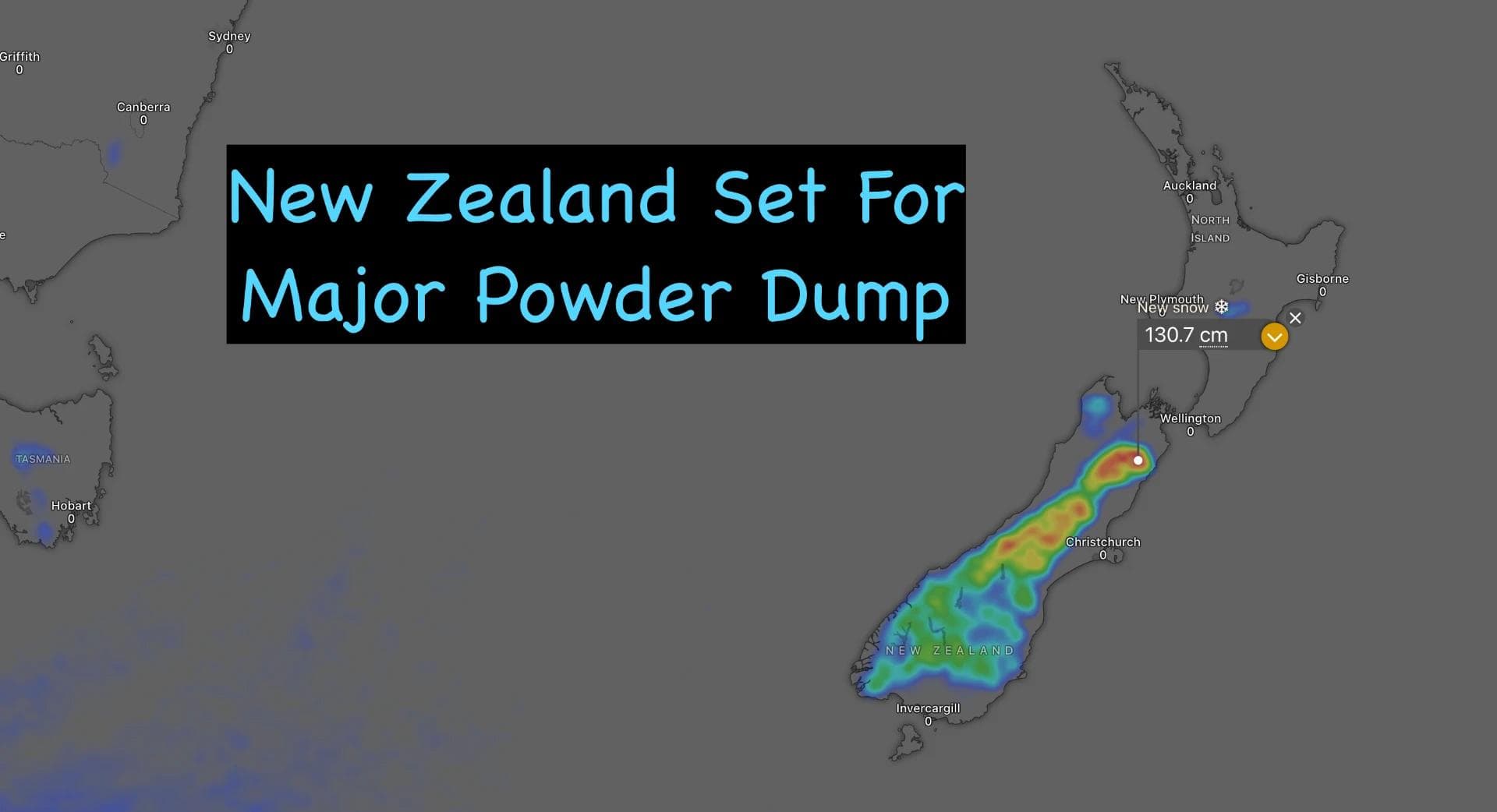
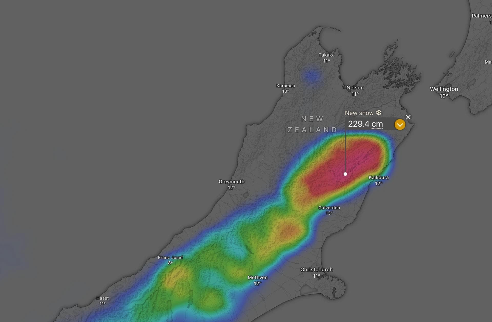
Canterbury Set for Major Dump as Storm Cycle Rolls Across New Zealand
Published Date:

Melbourne-based skier and snowboarder with 50+ resorts across 5 continents. Specialises in Australian resorts and international resort comparisons.
Categories

A week of sunshine is about to give way to New Zealand's first real storm cycle of the season, with Canterbury shaping up as the big winner.
A weather system approaching from the west will bring deteriorating conditions to the South Island from Friday, building into a stormy Saturday before a cold southerly change ushers in the goods from Sunday. The Southern Lakes are forecast to pick up 10 to 15 centimetres or more of fresh snow by Sunday morning, while Canterbury's ski fields are set for a more substantial hit as the cold air pushes north through the following days. Mt Ruapehu sits largely north of the action and should see only light falls on the upper slopes, but that's shaping up as good news for a fine Opening Day at Whakapapa and Turoa.
How the storm plays out
Friday brings strengthening northwesterlies and increasing rain to the Southern Lakes, spreading to other South Island fields by evening, while Mt Ruapehu enjoys a clear, calm day for Opening Day. Saturday turns wild across the South Island, with severe gale-force winds and heavy rain before colder air begins lowering snow levels later in the day. The change arrives properly overnight into Sunday, when cold southerlies push into the Southern Lakes and bring snow to low levels through the morning. Canterbury's snowfall builds through Sunday and becomes heavy overnight, continuing through Monday and Tuesday as the heaviest totals settle across the region, before the system eases through Tuesday and clears to sunny skies by the afternoon.
A further southeasterly surge is forecast to bring Canterbury another 10 to 30 centimetres from Wednesday the 8th through to Friday the 10th of July, with the Southern Lakes picking up a dusting and topping up with snowmaking. Mt Ruapehu should finally see southerlies arrive later in this window, bringing snow to the mid and upper slopes, though colder temperatures behind it should help snowmaking fill in the gaps lower down. A further storm cycle is already being watched for around 14 July.
What the numbers say
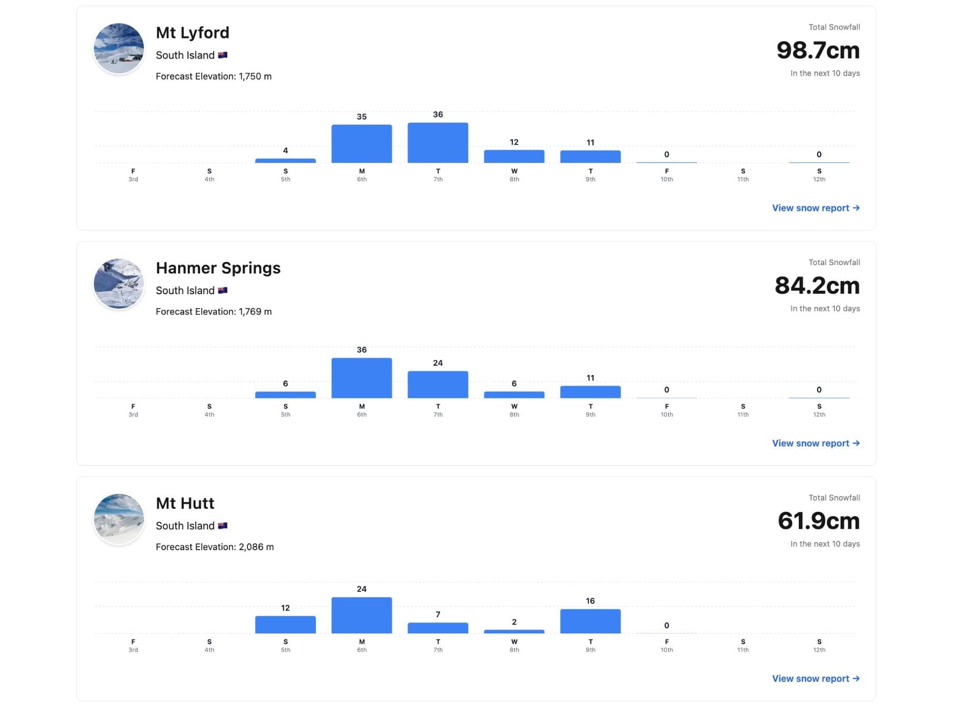
Forecast totals varied noticeably by source for this storm. SnowStash's own forecast data - the authoritative figure for SnowStash's snow reporting - puts Mt Hutt at 61.9cm and the Craigieburn fields at 36cm over the next 10 days, broadly in line with reporter commentary describing the Mt Hutt and Craigieburn Range fields as being in for a solid 35 to 60cm during the main storm window. Hanmer Springs is forecast 84.2cm and Mt Lyford 98.7cm over the same period on SnowStash's data - both healthy totals for the north, though considerably more conservative than reporter narratives describing Mt Lyford as set to be "buried" under more than 150cm. In the Southern Lakes, SnowStash has Cardrona picking up around 16.6cm and Treble Cone 15.3cm across the full 10-day outlook, consistent with reporter accounts of an early-week 10 to 15cm hit before falls tail off. Mt Ruapehu's North Island fields - Whakapapa, Turoa and Tukino - sit at a modest 4.8cm each on SnowStash's data, supporting the "misses out" framing used elsewhere.
It's worth noting that SnowStash's forecasts consistently sit on the conservative side of other models and reporter narratives. That's by design - when it comes to snowfall, it's better to under-predict and have a storm over-deliver than to promise big numbers and leave skiers disappointed. Worth keeping in mind heading into the week: if this storm behaves anything like recent history, some of these totals may prove to be the floor rather than the ceiling.