
Urabandai
300m vertical, 7m snowfall, north-facing slopes above frozen Lake Hibara. Kitashiobara, Fukushima Prefecture.
Season 2025-2026
Opens
5 Dec 2025
Closes
29 Mar 2026
Days open
114
Annual snow
7m
The Overview
Michael Fulton
Melbourne-based skier and snowboarder with 50+ resorts across 5 continents. Specialises in Australian resorts and international resort comparisons.
Urabandai operates three runs spanning 300 vertical metres from a 1,200-metre summit to a 900-metre base, with 1.9 kilometres of groomed terrain spread across 74 acres. The resort's 7 metres of annual snowfall blankets slopes divided into 50 per cent beginner, 30 per cent intermediate and 20 per cent advanced terrain. Located within Bandai-Asahi National Park, the area sits on the north face of Mount Bandai at an elevation of 800 metres above sea level in Kitashiobara village.
The main Family Trail stretches 200 metres wide, offering gentle, uncrowded runs for novice skiers and families seeking a relaxed introduction to skiing. A modest terrain park features boxes, jump platforms and two-way kickers that draw snowboarders during weekend sessions. Indoor practice slopes allow children to ski when weather deteriorates. The compact layout delivers efficient lap flow without requiring shuttle buses between sectors.
Views from the summit take in the frozen expanse of Lake Hibara and the snow-draped crater walls of Mount Bandai, formed during the 1888 volcanic eruption. Base facilities include a day nursery operating 9:00 to 16:00 for 1,500 yen per session, allowing parents to bank childcare throughout the day. The ski centre serves Aizu regional specialities and accepts PayPay mobile payments. Weekday attendance remains light, with Tokyo crowds concentrating on Saturday and Sunday.
Urabandai functions as a standalone resort without regional pass connections, drawing families seeking entry-level terrain and snowshoe trekkers accessing Yellow Falls, a frozen waterfall visible only during peak winter cold. The area suits absolute beginners, young children and visitors prioritising scenery over vertical challenge. Lift operations run 8:30 to 16:00 with no night skiing available.
300m
Vertical
3
Runs
74 acres
Skiable
7m
Annual snow
The Terrain
3 runs across 74 acres skiable
Urabandai is among the smallest resorts in this group, a 30-hectare area with three runs and 300 vertical metres between a 900-metre base and the 1,200-metre top on the north face of Mount Bandai. Half the terrain is beginner, 30% intermediate and 20% advanced, and nothing is expert. Three double chairs make up the entire lift network, with no gondola or surface tows. That simplicity is the point: there is no navigation to worry about, and the trip is a short, relaxed ski day with a family or a group of beginners in a quiet part of Fukushima.
Because the runs are short, the mountain suits learners who want lots of repetition, and parents can ski a loop with children without losing sight of them. Intermediates can step up to the pitchier runs, though they will see all of it within a couple of hours. Experienced skiers will not find much here beyond a warm-up. Urabandai rewards visitors who pair it with neighbouring areas such as Grandeco or Nekoma, where the terrain is bigger. For a gentle introduction to Japanese snow, it is a practical and low-pressure place to start.
Terrain split
3
runs
3 runs across 4 grades
Beginner2 runs · 50%
Intermediate1 run · 30%
Advanced1 run · 20%
Expert0 runs · 0%
Time it right
When to visit Urabandai
Operations run from 19 December 2025 through 22 March 2026, with lifts spinning Friday through Monday plus national holidays including 11 February and daily from 26 December to 5 January during the New Year period. The roughly 13-week season aligns with the Tohoku region's reliable winter window. Hours hold at 8:30 to 16:00 throughout the season with no extended spring operations.
The north-facing slopes receive 7 metres of average annual snowfall, benefiting from moisture-laden systems tracking inland from the Sea of Japan. Base elevation at 900 metres and summit at 1,200 metres provide adequate cold retention for natural snow preservation without extensive snowmaking infrastructure. The frozen surface of Lake Hibara, visible from upper slopes, confirms the area's sustained winter cold. Snow quality peaks during January and February when temperatures drop low enough to form Yellow Falls, the frozen waterfall accessed via snowshoe treks from the resort.
Mid-January through mid-February delivers the most consistent powder conditions and the deepest base depths, though weekend crowds increase during this prime period. Early season and March offer thinner visitor numbers on groomed surfaces. Late March sees spring corn development on sunny aspects. The resort operates only four days weekly outside holiday periods, making weekday visits impossible for much of the season.
The Yellow Falls snowshoe programme runs 27 December 2025 through 22 March 2026, providing guided winter trekking to the ice formation during operating days. No night skiing programme exists despite weekend demand at larger neighbouring resorts. The resort closed on 22 March 2026 after the most recent season, maintaining a consistent late-March closure date.
Season 2025-2026
5 Dec 2025
Opens
29 Mar 2026
Closes
114
Days open
7 m
Annual snow
Getting there
Getting to Urabandai, and where to stay
Urabandai sits within Kitashiobara village in northern Fukushima Prefecture, occupying the Urabandai Highlands at 800 metres elevation on the north flank of Mount Bandai. The resort lies within Bandai-Asahi National Park, Japan's second-largest national park spanning Fukushima, Yamagata and Niigata prefectures. Lake Hibara, Japan's largest crater lake formed during the 1888 volcanic eruption, spreads below the ski slopes with a 31-kilometre shoreline.
Inawashiro, 25 kilometres south, serves as the nearest town with full services and rail connections via the JR Banetsu West Line. Koriyama, Fukushima Prefecture's commercial centre 50 kilometres southeast, provides the main transport hub for visitors arriving by shinkansen. The village of Kitashiobara, with 2,697 residents, functions as the immediate local community. The Urabandai Highlands encompass more than 300 lakes and ponds created by the 1888 debris avalanche.
Drivers exit the Banetsu Expressway at Inawashiro Bandai Kogen Interchange, then follow National Route 115 to Prefectural Route 459 towards Urabandai for 25 kilometres, requiring approximately 30 minutes from the interchange. From Tokyo, the Tohoku Expressway connects to the Banetsu Expressway via Koriyama Junction, totalling roughly 3 hours and 7,000 yen in tolls. Free shuttle buses connect area hotels including Urabandai Kogen Hotel and Lake Resort Urabandai to the slopes.
Fukushima Airport lies 27 kilometres from Koriyama, with buses running 40 minutes to Koriyama Station for 1,120 yen. Tokyo Haneda sits 200 kilometres distant, with most visitors taking the Tohoku Shinkansen to Koriyama in 80 minutes, transferring to the Banetsu West Line for 40 minutes to Inawashiro Station. Bandai Toto buses run from Inawashiro to Urabandai Kogen in 50 minutes for 910 yen, operating roughly every 1-2 hours.
Where to stay
Search all stays →Hotels and lodges near Urabandai, powered by Stay22.
Latest News
From the SnowStash desk

Europe Ski Resorts Open Now: What Is Skiable in Mid-October 2026
Europe’s ski season is open, technically. After a record-warm summer, glaciers in Austria, Switzerland and Italy are running a few pistes apiece, Sölden, Stubai and Kitzsteinhorn started late, Titlis has pushed back to 24 October, and Zermatt reopens a few lifts on 14 October after more than two months shut. Finland’s Levi and Ruka are skiing on stored snow. Here is what is open, and what you actually get at each.
14 Oct 2026

Zermatt Plans World Cup Downhill Return on the Gornergrat for 2028
Zermatt is having another crack at a World Cup downhill, and this time nobody has to cross a border. Around 13 million Swiss francs is going into rebuilding the Gornergrat piste, including a jump fed by a roughly 300-metre in-run across the roof of the Gornergrat Railway gallery, with the Matterhorn lined up behind it for the TV cameras. First men’s race is pencilled in for March 2028, pending FIS homologation.
14 Oct 2026

Mt. Rose Begins Snowmaking for the 2026-27 Season at Lake Tahoe
Lake Tahoe’s highest base elevation is paying off early: Mt. Rose has started making snow for 2026-27 after the first flurries and a cold snap. The Nevada resort is backing it with nearly US$2 million in upgrades, including a replacement snowmaking main line, a new PistenBully groomer and restraint bars on every lift. Opening day is yet to be confirmed, though Heavenly and Northstar are already eyeing 20 November.
13 Oct 2026

Utah Ski Resorts 2026-27: What’s New at Alta, Deer Valley, Powder Mountain and More
Utah is still building flat out. For 2026-27, Powder Mountain opens a steep new Skytrac chair into more than 1,000 acres of advanced terrain, Deer Valley adds 200 acres on Hail Peak, Sundance gets a new quad and Park City adds a gondola from its new parking structure. Snowmaking is expanding almost everywhere, Eagle Point stays closed after the Cottonwood Fire, and the 2034 Games are setting the pace. Here’s what’s new, resort by resort.
13 Oct 2026

Mt Hutt Invests NZ$12 Million in Base Area, Tripling Its Sun Deck
Mt Hutt is getting busier, and its base lodge is about to catch up. NZ$12 million goes into a heated sun deck roughly three times the current size (430 m² to 1,300 m²), plus a new toilet block, heated steps down to snow level, extra storage and a new food and beverage outlet. Building starts after the 2026 season, with everything due for winter 2027.
11 Oct 2026

Vermont Ski Resort Opening Dates 2026-27: Few Dates Set, Killington Waits on the Cold
Vermont's season is slow to take shape. Stratton is tentatively targeting 18 November and Sugarbush 21 November, while Pico has Friday 11 December on the calendar. Killington never sets a date and opens when the snowmaking allows, and Vail Resorts has yet to name days for Stowe, Okemo and Mount Snow. The forecasts disagree about snow, and the main El Niño worry for the Green Mountains is warmth.
9 Oct 2026
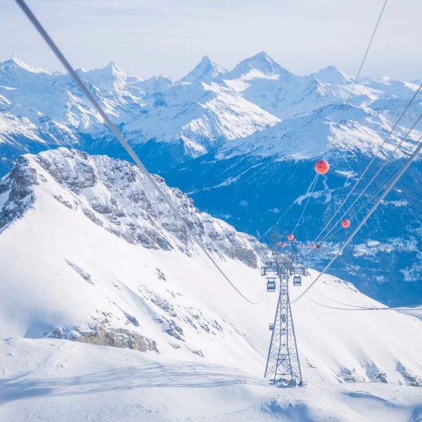
Crans-Montana 2027 World Championships President Resigns Ahead of Fraud Hearing
Less than four months out from the Crans-Montana 2027 World Championships, the man running the organising committee has stepped down. Claude-Alain Schmidhalter resigned as Swiss-Ski vice president and OC president after being indicted over a business dispute unrelated to skiing. He denies the allegations and faces court on October 27. Interim leaders are in place for the February 1-14 event.
9 Oct 2026
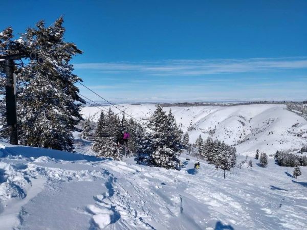
Kelly Canyon, Idaho, Adds Snowmaking, a Bigger Terrain Park and More Parking for 2026-27
Kelly Canyon had a rough 2025-26, and the Idaho resort has spent the summer making sure it doesn’t repeat. Snowmaking now reaches the top of Goldrush, the terrain park is doubling in size with a stereo system, lights and a snack shack, and the car park is getting bigger. Grooming is stepping up too. Target opening is December 4, conditions permitting.
9 Oct 2026