
Porters
678m vertical, 21 runs, 6 lifts. Big Mama descent, family terrain, 90 mins from Christchurch. Kids 10 & under free.
Season 2026
Opens
26 June 2026
Closes
27 Sept 2026
Days open
93
Annual snow
3m
The Overview
Michael Fulton
Melbourne-based skier and snowboarder with 50+ resorts across 5 continents. Specialises in Australian resorts and international resort comparisons.
Porters operates across 285 hectares between 1,302 and 1,980 metres elevation with 678 metres of vertical drop, making it one of Canterbury's most accessible commercial ski areas. The terrain spreads across 21 runs with 15 per cent beginner, 50 per cent intermediate and 35 per cent advanced terrain, supported by 2.5 metres of average annual snowfall and snowmaking coverage along main pistes. Big Mama provides 620 metres of vertical in a single run, one of New Zealand's longest lift-accessed descents, whilst Bluff Face offers 38-degree pitches for advanced skiers. Children 10 and under ski free, with adult day passes priced at $149 and season passes from $1,199.
The ski area divides into clearly defined zones with gentle beginner slopes at the base transitioning to steeper upper bowls accessed by three consecutive T-bars. Intermediate terrain follows groomed runs down Easy Street and the chairlift line, whilst advanced runs including Headwall, Julian's Bowl and McNulty's Basin fan across the upper mountain. Big Mama towers above the base area's true right, often requiring specific snow cover to open fully. Terrain park features sit mid-mountain near the chairlift, offering rails, boxes and tables for progression.
Porters maintains a family-friendly, uncrowded atmosphere particularly on weekdays, with compact facilities that keep beginners close to the car park and café. The 120-seat licensed café serves espresso and hearty fare, whilst Porters Lodge offers 42 beds along the access road for overnight guests. The field's southeast-facing main gully retains snow differently across aspects, and its relative protection from wind allows partial operations when neighbouring areas close. Views from the summit ridgeline extend across Lake Coleridge and the Southern Alps, though the base area sits in a scree-dominated valley that loses sun early in the afternoon.
Porters operates independently without multi-resort pass connections, running a typical June-to-September season. The 2026 season opens 26 June and closes 27 September, with lifts operating 9am to 4pm daily. The resort suits beginners progressing to intermediate level, families seeking short access and affordability, and advanced skiers willing to traverse for steeper lines and accessible backcountry via Crystal Valley and Powder Bowl.
678m
Vertical
21
Runs
704 acres
Skiable
3m
Annual snow
The Terrain
21 runs across 704 acres skiable
Porters spreads across roughly 285 hectares of the Craigieburn Range, rising from 1,302 to 1,980 metres for a vertical of 678 metres. Its 21 runs are weighted towards the middle: 15% beginner, 50% intermediate, 30% advanced and 5% expert. That gives a solid mix with a real top end, which is unusual for a field only 89 kilometres from Christchurch. The upper mountain is exposed and alpine, and the lower slopes are gentler, so the character of the skiing shifts as you move up. A modest lift network keeps the scale easy to read, and the vertical is large enough to feel serious.
A quad chair covers the lower mountain, with T-bars continuing higher towards the ridges, and a beginner platter and magic carpet handle first-timers near the base. Big Mama is the best-known advanced area, with Bluff Face another step up for those wanting steep, committing lines. Mid-level skiers will find plenty of rolling cruising between the two extremes. Porters suits intermediates ready to try something bigger, plus advanced skiers who want genuine pitch without crowds. Those aiming for expert terrain should treat it as a day-trip option, since there are only a few runs in that grade.
Terrain split
21
runs
21 runs across 4 grades
Beginner3 runs · 15%
Intermediate11 runs · 50%
Advanced6 runs · 30%
Expert1 run · 5%
Time it right
When to visit Porters
The 2026 winter season runs from 26 June through 27 September, typical of Canterbury commercial fields operating mid-June to late September. Lifts operate 9am to 4pm seven days per week, weather permitting. Season length averages 14 to 16 weeks depending on early and late-season snow conditions. Historic opening has occasionally stretched into early October during strong snow years, whilst poor autumns have delayed June starts.
Annual snowfall averages 2.5 metres across the ski area, supplemented by extensive snowmaking on main pistes along the chairlift line and Easy Street. The resort sits at the southern end of the Craigieburn Range, receiving snow from both northwest-turning southerly systems and moist easterly flows off the Pacific. The chairlift and main gully face southeast, creating variable snow quality across the mountain's different aspects. Base depth reliability benefits from the 1,302-metre base elevation, though Big Mama's sun-exposed position can suffer thin cover during warm spells. Snow quality varies significantly between powder days and melt-freeze cycles, with limited groomed runs making hard-pack conditions challenging.
July and August provide peak snowfall and coldest temperatures, with the resort recording -15.37 degrees Celsius in August 2011. Early season June conditions favour groomed runs whilst the snowpack builds, with sidecountry areas requiring deeper cover. Spring September skiing transitions to softer snow and longer daylight, attracting families and value-seekers. The snowiest period typically falls in the second week of October, though the resort has usually closed by then. Midweek visits offer the quietest experience, with weekends and July school holidays bringing the largest crowds—one July 2021 day recorded 1,200 skiers.
Porters hosts beginner programmes including the five-day Porters Passport, which bundles lessons, lift access and a complimentary season pass upon completion. Night skiing does not feature in the regular programme, though the field occasionally offers evening terrain park sessions. No major event calendar runs through winter beyond standard school holiday promotions. The resort's focus remains day operations for Christchurch residents, with shuttle services operating weekends and during chain-required conditions on the 8-kilometre access road.
Season 2026
26 June 2026
Opens
27 Sept 2026
Closes
93
Days open
3 m
Annual snow
Getting there
Getting to Porters, and where to stay
Porters sits at the southern end of the Craigieburn Range in Canterbury's high country, 98 kilometres west of Christchurch at an elevation of 1,302 metres. The ski area occupies scree-covered terrain—approximately 80 per cent loose rock—above the Castle Hill Basin, with State Highway 73 running through the valley floor below. Lake Coleridge lies to the southwest, whilst the Torlesse Range defines the basin's eastern edge. The resort occupies conservation land adjacent to Craigieburn Forest Park, with neighbouring club fields including Mount Cheeseman, Broken River and Craigieburn Valley scattered along the range.
Springfield, a small rural town 33 kilometres east via Highway 73, provides the nearest services including petrol and basic supplies. Castle Hill Village sits 17 kilometres from the ski area turnoff, offering limited accommodation in an alpine settlement. Methven lies approximately 75 minutes southeast via Lake Lyndon Road, though this route remains ungritted and sketchy in winter. Christchurch provides full urban amenities 90 to 110 minutes away depending on traffic and conditions. The resort markets itself as Canterbury's closest commercial field to the city, a key selling point for day-trippers.
The access road branches 8 kilometres from Highway 73, with a well-signposted turnoff located roughly 10 kilometres past the summit of Porters Pass when approaching from Christchurch. The unsealed mountain access road climbs 8 kilometres from the highway junction to the base facilities, winding through open terrain without the native beech forests that characterise some neighbouring club fields. Chains are often required, with a complimentary shuttle operating from the chain-fitting area to the ticket office on weekends, holidays and whenever chains are compulsory. The access is considered shorter and less intimidating than many Canterbury ski roads, though still unpaved with no safety barriers.
Christchurch International Airport lies 89 kilometres southeast, roughly 70 to 90 minutes by car depending on conditions. No direct public transport serves the ski area, though commercial shuttle operators run daily services from Christchurch, Methven and Springfield. Arthur's Pass National Park sits 40 kilometres further west along Highway 73, with the West Coast town of Greymouth 180 kilometres away, making Porters a potential stopover for trans-Alpine itineraries. No passenger rail connects to the region, with road access via Highway 73 remaining the sole practical route year-round.
Where to stay
Search all stays →Hotels and lodges near Porters, powered by Stay22.
Latest News
From the SnowStash desk
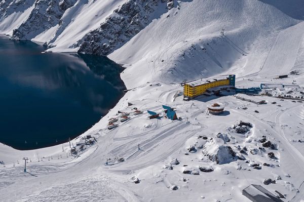
Four Dead After Avalanche Near Ski Portillo in Chile
A large avalanche struck near Laguna del Inca adjacent to Ski Portillo on Saturday afternoon, killing four people and injuring four others. The group were day visitors mountaineering in the backcountry after reportedly being warned about elevated avalanche risk by resort staff.
18 Oct 2026

Europe Ski Resorts Open Now: What Is Skiable in Mid-October 2026
Europe’s ski season is open, technically. After a record-warm summer, glaciers in Austria, Switzerland and Italy are running a few pistes apiece, Sölden, Stubai and Kitzsteinhorn started late, Titlis has pushed back to 24 October, and Zermatt reopens a few lifts on 14 October after more than two months shut. Finland’s Levi and Ruka are skiing on stored snow. Here is what is open, and what you actually get at each.
14 Oct 2026

Zermatt Plans World Cup Downhill Return on the Gornergrat for 2028
Zermatt is having another crack at a World Cup downhill, and this time nobody has to cross a border. Around 13 million Swiss francs is going into rebuilding the Gornergrat piste, including a jump fed by a roughly 300-metre in-run across the roof of the Gornergrat Railway gallery, with the Matterhorn lined up behind it for the TV cameras. First men’s race is pencilled in for March 2028, pending FIS homologation.
14 Oct 2026

Mt. Rose Begins Snowmaking for the 2026-27 Season at Lake Tahoe
Lake Tahoe’s highest base elevation is paying off early: Mt. Rose has started making snow for 2026-27 after the first flurries and a cold snap. The Nevada resort is backing it with nearly US$2 million in upgrades, including a replacement snowmaking main line, a new PistenBully groomer and restraint bars on every lift. Opening day is yet to be confirmed, though Heavenly and Northstar are already eyeing 20 November.
13 Oct 2026

Utah Ski Resorts 2026-27: What’s New at Alta, Deer Valley, Powder Mountain and More
Utah is still building flat out. For 2026-27, Powder Mountain opens a steep new Skytrac chair into more than 1,000 acres of advanced terrain, Deer Valley adds 200 acres on Hail Peak, Sundance gets a new quad and Park City adds a gondola from its new parking structure. Snowmaking is expanding almost everywhere, Eagle Point stays closed after the Cottonwood Fire, and the 2034 Games are setting the pace. Here’s what’s new, resort by resort.
13 Oct 2026

Mt Hutt Invests NZ$12 Million in Base Area, Tripling Its Sun Deck
Mt Hutt is getting busier, and its base lodge is about to catch up. NZ$12 million goes into a heated sun deck roughly three times the current size (430 m² to 1,300 m²), plus a new toilet block, heated steps down to snow level, extra storage and a new food and beverage outlet. Building starts after the 2026 season, with everything due for winter 2027.
11 Oct 2026

Vermont Ski Resort Opening Dates 2026-27: Few Dates Set, Killington Waits on the Cold
Vermont's season is slow to take shape. Stratton is tentatively targeting 18 November and Sugarbush 21 November, while Pico has Friday 11 December on the calendar. Killington never sets a date and opens when the snowmaking allows, and Vail Resorts has yet to name days for Stowe, Okemo and Mount Snow. The forecasts disagree about snow, and the main El Niño worry for the Green Mountains is warmth.
9 Oct 2026
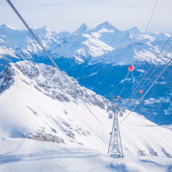
Crans-Montana 2027 World Championships President Resigns Ahead of Fraud Hearing
Less than four months out from the Crans-Montana 2027 World Championships, the man running the organising committee has stepped down. Claude-Alain Schmidhalter resigned as Swiss-Ski vice president and OC president after being indicted over a business dispute unrelated to skiing. He denies the allegations and faces court on October 27. Interim leaders are in place for the February 1-14 event.
9 Oct 2026