
Temple Basin
320-hectare club field at Arthur's Pass. 430m vertical, 3 rope tows, 45-min hike access. Ungroomed alpine terrain, South Island NZ.
Season 2026
Opens
9 Aug 2026
Closes
27 Sept 2026
Days open
49
Annual snow
3m
The Overview
Michael Fulton
Melbourne-based skier and snowboarder with 50+ resorts across 5 continents. Specialises in Australian resorts and international resort comparisons.
Temple Basin operates across 320 hectares of ungroomed alpine terrain between 1,326 and 1,753 metres elevation in Arthur's Pass National Park. The club field, established in 1929, spans 36 runs with a 430-metre vertical drop and receives 2.5 metres of natural snowfall annually. Its position on the western side of the Southern Alps ensures consistent snowfall compared to eastern ranges. Non-member day passes cost $85, with discounted rates for club members and affiliate club members.
The terrain splits 25% beginner, 50% intermediate, 15% advanced and 10% expert, spread across four main basins. Cassidy Tow accesses open beginner and intermediate slopes, whilst Temple Tow serves steeper pitches. Downhill Tow reaches the highest elevations, opening up Bills Basin with its intermediate bowls and chutes. Much of the advanced terrain requires hiking from the top of Downhill Tow, including access to Blimit and Mt Temple peaks and the unpatrolled Mingha Valley beyond the ridgeline.
Access requires a 45-minute uphill hike from the car park, though a motorised goods lift transports equipment. Two lodges provide 120 bunks total with ski-in/ski-out access, hot showers, mains power and a full-time chef. The volunteer-run operation maintains an authentic club field atmosphere focused on mountain experience rather than resort conveniences. All terrain remains ungroomed, and no snowmaking supplements natural snowfall, creating variable conditions that reward adaptability and fitness.
The field operates independently with no commercial pass affiliations. The 2026 season runs from 9 August to 27 September, though dates vary with snowfall. Temple Basin suits intermediate to expert skiers comfortable with rope tows and hike-to terrain, particularly those seeking backcountry-style skiing within a patrolled environment. Night skiing operates on Temple Tow when conditions permit, and the New Zealand Snow Safety Institute runs avalanche and mountaineering courses from the lodges throughout winter.
430m
Vertical
36
Runs
791 acres
Skiable
3m
Annual snow
The Terrain
36 runs across 791 acres skiable
Temple Basin is a high alpine ski area on the Main Divide of the Southern Alps, within Arthur's Pass National Park, covering around 320 hectares between 1,493 and 1,923 metres. Skiers reach it on foot, via a steep walking track of about 45 minutes, with a goods lift carrying gear to the lodge. That arrival sets the tone. The 36 runs split 25% beginner, 50% intermediate, 15% advanced and 10% expert across several separate basins, and the 430-metre vertical is enough to feel like a proper mountain. Access effort keeps numbers low.
Three nutcracker rope tows and a fixed-grip learner tow cover the basins, so users need to be comfortable gripping on. Bills Basin holds a natural terrain park of chutes, bowls and half-pipes shaped by the mountain itself. Steeper lines and chutes provide the advanced and expert terrain, while the intermediate share offers long open slopes beneath. Temple Basin suits fit intermediates, advanced skiers and riders who enjoy a rugged, lodge-based club atmosphere. Beginners are catered for on the learner tow, but the walk-in and rope tows make it a poor choice for a first-ever ski day.
Terrain split
36
runs
36 runs across 4 grades
Beginner9 runs · 25%
Intermediate18 runs · 50%
Advanced5 runs · 15%
Expert4 runs · 10%
Time it right
When to visit Temple Basin
The 2026 season operates from 9 August to 27 September, spanning seven weeks of winter skiing. Typical seasons run mid-July through September when snow depths permit, with operations entirely dependent on natural snowfall. Opening and closing dates shift annually based on accumulation and spring melt. The field occasionally extends into October during high-snow years.
Temple Basin receives 2.5 metres of average annual snowfall, with its western position on the Main Divide capturing storms moving across the Tasman Sea. The second week of July typically delivers peak snowfall with 34 centimetres over 3.4 snowy days. No snowmaking supplements natural conditions, and the entirely ungroomed terrain retains powder longer than commercial fields. Elevation advantage at the 1,326 to 1,753-metre range maintains snow quality through midwinter.
August and September deliver optimal conditions with established base depths and reliable coverage across all basins. Mid-July through August offers the deepest powder and most consistent snowfall. Spring conditions develop in late September with sunny days and softening snow. Midweek periods see lighter crowds compared to weekends, when the two lodges often reach their 120-person capacity.
The field hosts supervised ski weeks for children and learner events early season to introduce beginners to rope tows. Night skiing operates on Temple Tow when conditions and weather permit, with powerful lights illuminating the slope. The New Zealand Snow Safety Institute schedules mountaineering, avalanche awareness and ski touring courses throughout winter. No major festivals or events interrupt regular operations, maintaining focus on daily skiing and lodge-based social evenings.
Season 2026
9 Aug 2026
Opens
27 Sept 2026
Closes
49
Days open
3 m
Annual snow
Getting there
Getting to Temple Basin, and where to stay
Temple Basin sits within Arthur's Pass National Park on the Main Divide of the Southern Alps in Canterbury. The car park lies beside State Highway 73, 4 kilometres west of Arthur's Pass Village, at approximately 900 metres elevation. The lodges sit at 1,326 metres, surrounded by peaks including Mt Temple, Blimit and Mt Cassidy. The Waimakariri River valley runs east toward the Canterbury Plains.
Arthur's Pass Village, 4 kilometres east, provides the nearest services including a store, café and visitor centre. Christchurch, 146 kilometres east, offers full city amenities as Canterbury's main hub. Springfield, 76 kilometres from the car park, has basic services. The region experiences alpine weather with northwest storms bringing snow and unpredictable visibility. The Craigieburn Range contains several other club fields within 30 kilometres.
State Highway 73 provides sealed access from Christchurch via Springfield and Castle Hill, requiring approximately two hours' drive. The road crosses Arthur's Pass at 920 metres elevation with chains sometimes required in winter. From the west, Greymouth lies 95 kilometres distant via the Otira Gorge. The Temple Basin car park sits directly off the highway with no access road to the ski area itself. Parking is unattended and free.
Christchurch International Airport lies 142 kilometres east with a drive time of 1 hour 40 minutes to the car park. The TranzAlpine train service runs daily between Christchurch and Greymouth, stopping at Arthur's Pass Village with a 2 hour 25 minute journey time. InterCity operates daily bus services from Christchurch to Arthur's Pass in 2 hours 15 minutes. East West Coaches provides shuttle services, and the goods lift then transports equipment up the final 45-minute walking track to the lodges.
Where to stay
Search all stays →Hotels and lodges near Temple Basin, powered by Stay22.
Latest News
From the SnowStash desk

Europe Ski Resorts Open Now: What Is Skiable in Mid-October 2026
Europe’s ski season is open, technically. After a record-warm summer, glaciers in Austria, Switzerland and Italy are running a few pistes apiece, Sölden, Stubai and Kitzsteinhorn started late, Titlis has pushed back to 24 October, and Zermatt reopens a few lifts on 14 October after more than two months shut. Finland’s Levi and Ruka are skiing on stored snow. Here is what is open, and what you actually get at each.
14 Oct 2026

Zermatt Plans World Cup Downhill Return on the Gornergrat for 2028
Zermatt is having another crack at a World Cup downhill, and this time nobody has to cross a border. Around 13 million Swiss francs is going into rebuilding the Gornergrat piste, including a jump fed by a roughly 300-metre in-run across the roof of the Gornergrat Railway gallery, with the Matterhorn lined up behind it for the TV cameras. First men’s race is pencilled in for March 2028, pending FIS homologation.
14 Oct 2026

Mt. Rose Begins Snowmaking for the 2026-27 Season at Lake Tahoe
Lake Tahoe’s highest base elevation is paying off early: Mt. Rose has started making snow for 2026-27 after the first flurries and a cold snap. The Nevada resort is backing it with nearly US$2 million in upgrades, including a replacement snowmaking main line, a new PistenBully groomer and restraint bars on every lift. Opening day is yet to be confirmed, though Heavenly and Northstar are already eyeing 20 November.
13 Oct 2026

Utah Ski Resorts 2026-27: What’s New at Alta, Deer Valley, Powder Mountain and More
Utah is still building flat out. For 2026-27, Powder Mountain opens a steep new Skytrac chair into more than 1,000 acres of advanced terrain, Deer Valley adds 200 acres on Hail Peak, Sundance gets a new quad and Park City adds a gondola from its new parking structure. Snowmaking is expanding almost everywhere, Eagle Point stays closed after the Cottonwood Fire, and the 2034 Games are setting the pace. Here’s what’s new, resort by resort.
13 Oct 2026

Mt Hutt Invests NZ$12 Million in Base Area, Tripling Its Sun Deck
Mt Hutt is getting busier, and its base lodge is about to catch up. NZ$12 million goes into a heated sun deck roughly three times the current size (430 m² to 1,300 m²), plus a new toilet block, heated steps down to snow level, extra storage and a new food and beverage outlet. Building starts after the 2026 season, with everything due for winter 2027.
11 Oct 2026

Vermont Ski Resort Opening Dates 2026-27: Few Dates Set, Killington Waits on the Cold
Vermont's season is slow to take shape. Stratton is tentatively targeting 18 November and Sugarbush 21 November, while Pico has Friday 11 December on the calendar. Killington never sets a date and opens when the snowmaking allows, and Vail Resorts has yet to name days for Stowe, Okemo and Mount Snow. The forecasts disagree about snow, and the main El Niño worry for the Green Mountains is warmth.
9 Oct 2026
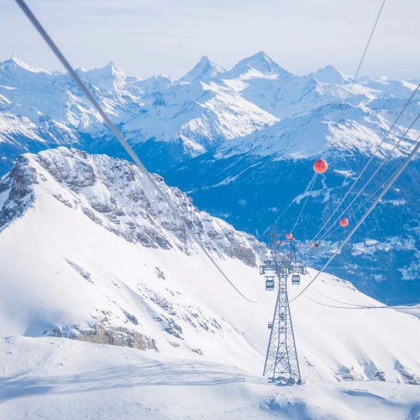
Crans-Montana 2027 World Championships President Resigns Ahead of Fraud Hearing
Less than four months out from the Crans-Montana 2027 World Championships, the man running the organising committee has stepped down. Claude-Alain Schmidhalter resigned as Swiss-Ski vice president and OC president after being indicted over a business dispute unrelated to skiing. He denies the allegations and faces court on October 27. Interim leaders are in place for the February 1-14 event.
9 Oct 2026
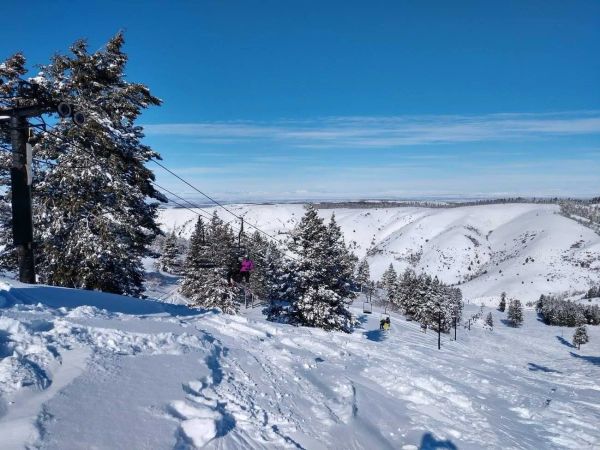
Kelly Canyon, Idaho, Adds Snowmaking, a Bigger Terrain Park and More Parking for 2026-27
Kelly Canyon had a rough 2025-26, and the Idaho resort has spent the summer making sure it doesn’t repeat. Snowmaking now reaches the top of Goldrush, the terrain park is doubling in size with a stereo system, lights and a snack shack, and the car park is getting bigger. Grooming is stepping up too. Target opening is December 4, conditions permitting.
9 Oct 2026
Temple Basin Snow Report
Snow Report
Awaiting live data
1923m
summit
+0cm
new snow · last 24 hours
-°C / -°C · - -
Snowfall
24 hours
0cm
48 hours
0cm
7 days
0cm
Base depth
-
Season total
-
Total lifts3
Live open status isn’t available right now.
9 Aug 2026 - 27 Sept 2026
Hour by Hour
Next 43 hours· Updated Oct 15, 2026 at 6:02 AM
Scroll for the full outlook · Open-Meteo
7-Day Outlook
1,923 mUpdated Oct 15, 2026 at 6:02 AMOpen-Meteo
Days 1–7
2.8cm
Days 8–14
8.4cm
Thu, Oct 15
Slight Rain Showers
Temp5° / -4°°C
Snow0.9cm(100%)
Wind28 km/h SW
Live snow from the resort feed; forecast from Open-Meteo, via Supabase.
Understanding the Temple Basin snow report
Track current conditions at Temple Basin in South Island. This report covers snowfall totals, base and summit depth, and the forecast across 36 runs.
Snow measurements
Our snow reports measure snowfall in centimeters over multiple time windows — last 24 hours, last 7 days, and the season total. Base depth reflects accumulation at the 1493m base area, while summit depth captures conditions 430m higher at 1923m, where snow typically stays colder and lingers longer. Imperial conversions are shown alongside for convenience.
Weather conditions
Current weather conditions affect snow quality. Cold temperatures with low wind typically preserve snow quality, while warm temperatures or rain can impact conditions negatively — something worth watching closely at Temple Basin's 1493m base elevation, where temperatures run milder than the summit.
Data sources
Temple Basin snow data is collected through a combination of on-mountain reports and weather forecasting services, giving you both official resort updates and independent forecast data in one place. The mountain is served by 3 lifts in total.
When to check
Conditions can change overnight, so mornings and late afternoons are the best times to check back on Temple Basin.