
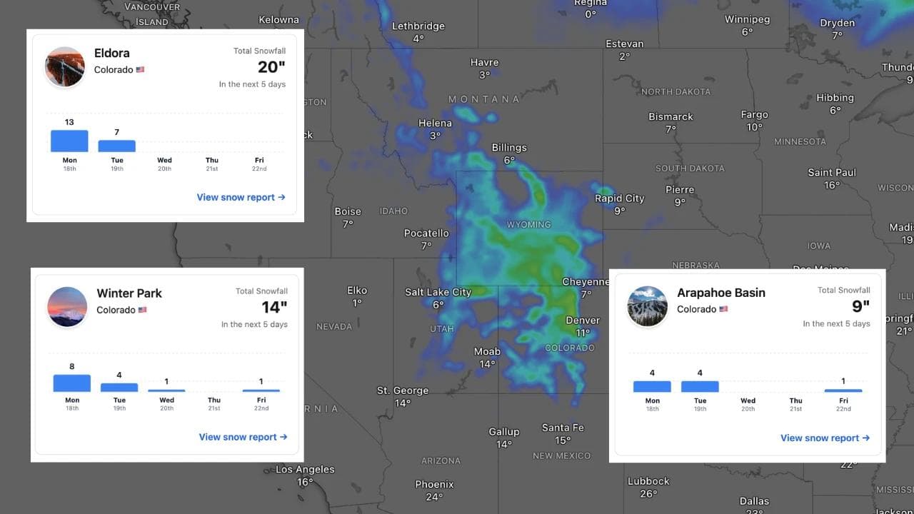
Colorado Snow Forecast: Eldora Leading the Way With 20 Inches as Late-May Storm Hits
Published Date:

Melbourne-based skier and snowboarder with 50+ resorts across 5 continents. Specialises in Australian resorts and international resort comparisons.

Eldora is forecast to pick up 20 inches from a late-May Colorado storm - and most resorts aren't even open to see it.
A cold trough pushing through Colorado from Sunday night into Monday is set to deliver the biggest late-season snowfall event in weeks, with Eldora leading all resorts at a forecast 20 inches. Winter Park isn't far behind at 7-11 inches, while Arapahoe Basin, Loveland, Keystone and Copper Mountain are all in the mix for meaningful accumulations. The catch is that most of Colorado's major resorts have already closed for the season - so the timing is better suited to a snow report bragging right than an actual powder day for most skiers.
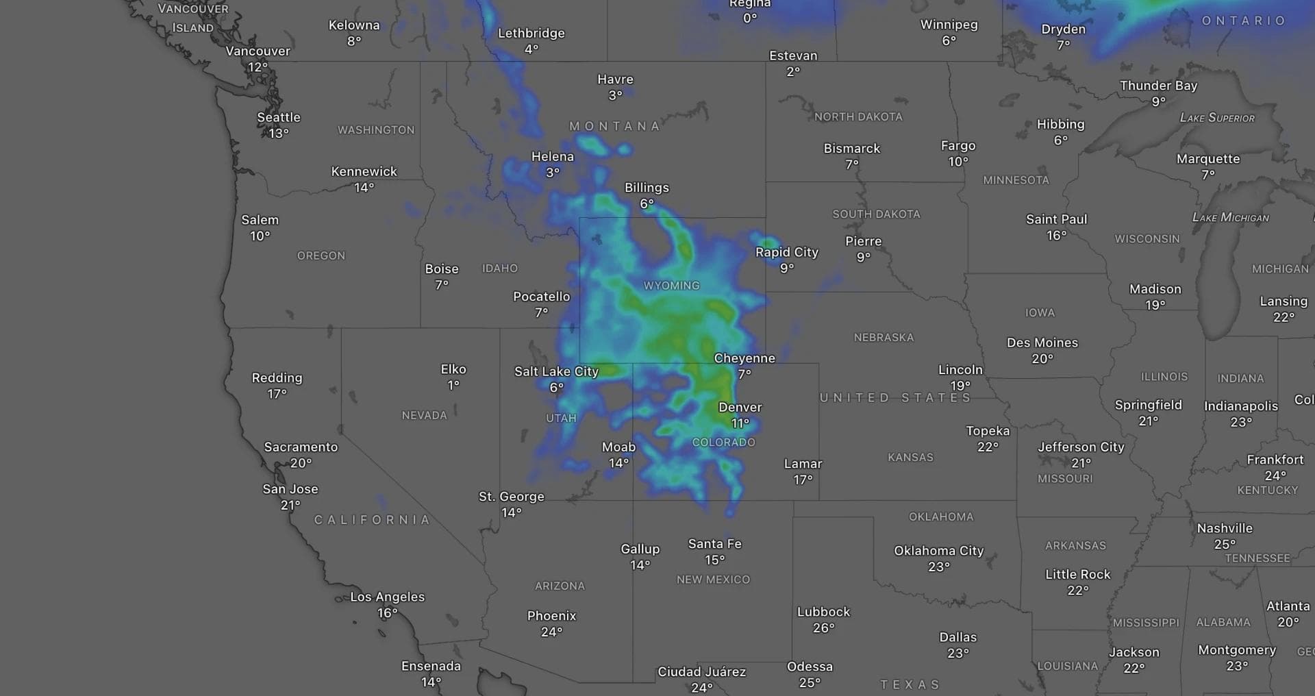
What the storm looks like
The setup involves a cold trough arriving Sunday night, dropping snow levels from roughly 10,000-11,000 feet early in the storm down to around 6,500-8,500 feet by Monday. That fall in snow levels is what makes the difference between a wet spring slush event and actual accumulating snow at upper-mountain elevations. Snow quality is expected to be dense early - snow-to-liquid ratios of around 8:1 to 12:1 - before briefly improving to 12:1 to 15:1 in colder Monday night showers. Not exactly powder, but a reasonable late-May outcome given the calendar.
Saturday afternoon and Sunday ahead of the main event are more unsettled than useful for accumulation, with showers and thunderstorms keeping snow levels generally above 9,500-11,500 feet during the warmer part of the weekend. Wind is also a factor - gusts forecast to reach 40-50 mph across the southern and central mountains as the trough approaches, which is worth factoring in for anyone still on snow.
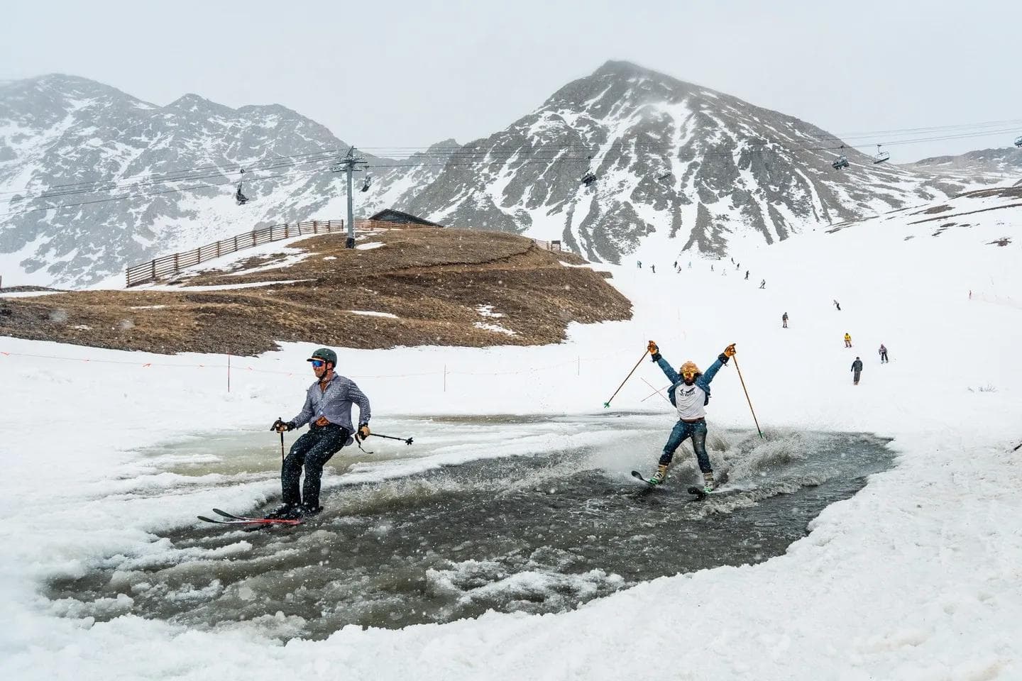
Arapahoe Basin's closing weekend
Arapahoe Basin was operating through Sunday as part of its closing weekend, with the Lake terrain - a high-elevation feature that doesn't open every season - reportedly accessible after a strong spring snowpack. Sunday's conditions ahead of the main storm are expected to be a typical spring day: changeable, with showers, gusts, and snow levels sitting too high for meaningful accumulation. The better snow arrives after operations wrap up, which is either unfortunate timing or a decent send-off depending on your perspective.
Resort-by-resort forecast totals (Sat 16 May - Wed 20 May)
- Eldora: 20"
- Winter Park: 7-11"
- Arapahoe Basin: 9"
- Loveland: 6"
- Keystone: 4"
- Copper Mountain: 4"
The northern resorts along and north of I-70 - the main east-west interstate through the mountains - are picking up the most from this system. The San Juans and central mountains see lighter accumulations.
What happens after Monday
Lingering snow showers are expected Tuesday and Wednesday, with the best odds staying near Winter Park, Loveland, Arapahoe Basin, and the Divide. Confidence drops after that. Temperatures moderate by Thursday and Friday, snow levels climb back above 9,500 feet, and any remaining showers look patchy. The longer-range outlook through late May trends warmer, so this system appears to be Colorado's last meaningful snow event of the 2025-26 season rather than the start of something sustained.