
Leysin
60km of pistes, 948m vertical, 72% beginner terrain. South-facing slopes in Canton Vaud with Magic Pass access.
Season 2026 - 2027
Opens
28 Nov 2026
Closes
11 Apr 2027
Days open
134
Annual snow
4m
The Overview
Michael Fulton
Melbourne-based skier and snowboarder with 50+ resorts across 5 continents. Specialises in Australian resorts and international resort comparisons.
Leysin operates from 1,250 to 2,198 metres across 60 kilometres of pistes and 948 metres of vertical drop in the Vaud Alps. The resort combines with Les Mosses and La Lécherette via shuttle bus to form a 100-kilometre ski area. Snowmaking covers a portion of the terrain, whilst the south-facing slopes deliver 1,900 hours of annual sunshine. Magic Pass holders access the full network without additional day tickets.
Beginner terrain dominates with 72 per cent of marked runs, leaving 25 per cent for intermediates and three per cent rated advanced. The ski area fans across two main sectors accessed from Leysin village: the Berneuse gondola serves wide upper slopes and tree-lined descents, whilst the Tête d'Aï chairlift opens terrain towards the 2,331-metre Tour d'Aï peak. Les Chaux and La Berneuse rank among the most frequented descents. Off-piste routes from La Berneuse at 2,048 metres attract experienced riders.
Leysin hosts several international boarding schools and maintains a youthful, diverse atmosphere on the mountain. The Kuklos revolving restaurant at 2,048 metres completes a 360-degree rotation in 90 minutes with views across Lake Geneva, Mont Blanc, the Matterhorn and the Eiger. Terrain parks traditionally featured half-pipes and jump lines, though conditions vary seasonally. The village sprawls across a sunny plateau at 1,260 metres above the Rhone Valley.
The Alpes Vaudoises regional pass extends access to Villars, Gryon, Les Diablerets and Glacier 3000, covering more than 225 kilometres of terrain within a 30-minute radius. The 2025-26 season runs from 7 December to 6 April. Leysin suits learners, families and intermediates seeking accessible Swiss skiing without the scale or price point of larger resorts. Limited expert pistes and moderate elevation require attention to snow forecasts in marginal conditions.
948m
Vertical
0
Runs
60 km
Piste
4m
Annual snow
The Terrain
0 runs across 60 km of piste
Leysin offers 60 kilometres of piste above the Rhône valley, dropping 948 metres from 2,198 metres to a village base at 1,250 metres. The terrain is gentle, at 72% beginner, 25% intermediate and 3% advanced, with no expert runs. One gondola, a six-seat chair, four quads and two double chairs carry the traffic, and the south-facing slopes soak up plenty of sun. It is a straightforward area to read, with few surprises for anyone arriving from a flatter ski background, and a handy base for learners who want views and space.
The area splits into the Berneuse and Tête d'Aï sectors, both reached from the village, and the Berneuse summit looks across the Rhône valley, with the revolving Kuklos restaurant a handy lunch stop. A shuttle bus connects to Les Mosses and La Lécherette, and the Alpes Vaudoises passes stretch the range further for those who buy them. Steep skiing is scarce, though some off-piste leaves the Berneuse ridge for experienced riders. Families, beginners and intermediates after relaxed cruising in the Vaud Alps will get the most from a stay.
Terrain split
0
runs
0 runs across 4 grades
Beginner0 runs · 72%
Intermediate0 runs · 25%
Advanced0 runs · 3%
Expert0 runs · 0%
Time it right
When to visit Leysin
The 2025-26 season operates from 7 December 2025 to 6 April 2026, spanning four months. Typical opening lands in early December, with closures extending into mid-April depending on snow cover. Historical records show opening dates as early as late November in strong snow years. Late and early season quality suffers due to the 1,250-metre base elevation and south-facing exposure.
Annual snowfall averages 4.3 metres, with week two of December historically the snowiest period, delivering 40 centimetres across 3.4 snowy days. February provides the deepest mid-season base, averaging 145 centimetres at summit elevation and 40 centimetres at the base. Snowmaking equipment covers five kilometres of priority runs with 68 snow cannons, focusing on lower slopes and high-traffic zones. Natural accumulation remains the primary source, with elevation and aspect influencing reliability.
January through March offer the most consistent conditions, with February delivering peak depth and cold temperatures. December suits early-season visitors willing to accept limited terrain, whilst March combines longer daylight and spring snow with the resort's famed sunshine. Weekday skiing avoids the school groups and weekend crowds that frequent Leysin due to its proximity to international schools. Midweek visits in January and February provide the best balance of snow quality and empty pistes.
Night skiing operates on floodlit slopes near the village, with tobogganing open from 10:00 to 20:00. The Giant X Tour snowboard and ski event finals traditionally occur at Leysin. Terrain park features remain condition-dependent, with recent seasons seeing closures in January. Cross-country trails extend 10 kilometres within the immediate area, with 39 kilometres across the broader region. The resort officially holds Swiss Tourism Federation family-friendly certification since 2001.
Season 2026 - 2027
28 Nov 2026
Opens
11 Apr 2027
Closes
134
Days open
4 m
Annual snow
Getting there
Getting to Leysin, and where to stay
Leysin sits in the Aigle district of Canton Vaud at 1,260 metres on a south-facing plateau above the Rhone Valley. The village occupies a natural terrace beneath the Tour d'Aï massif at 2,331 metres, with views extending across Lake Geneva to the Dents du Midi, Mont Blanc and the Bernese Alps. The Grande-Eau river runs through the valley below. Leysin forms part of the Vaud Alps in western Switzerland, positioned at the eastern end of Lac Léman.
Aigle lies 14 kilometres downhill in the Rhone Valley, serving as the primary rail hub and connecting point for regional trains. Montreux sits 20 kilometres west along the lake shore, nine minutes by train from Aigle. Lausanne is 45 kilometres northwest, whilst Geneva sits 97 kilometres west. The resort village itself spreads across three kilometres of mountainside with hamlets at Veyges, Feydey, Aï and Mayen. Several international schools and former sanatorium buildings occupy the lower slopes.
Road access follows the cantonal route from Aigle via Le Sépey, climbing through switchbacks to Leysin village. From Geneva, the A1 and A9 motorways connect via exit 17 at Aigle, with total drive time of 90 minutes covering 97 kilometres. Bern lies 120 minutes northeast via the A12 to Lausanne, then A9 towards Montreux. The route passes vineyards in the Chablais wine region and Aigle Castle. Parking concentrates near lift bases.
Geneva Airport is 122 kilometres west with transfers averaging 90 minutes by road or two hours 18 minutes by train via Aigle. Bern Airport sits two hours away, Zurich 150 minutes. Direct Swiss Federal Railway trains from Geneva to Aigle depart hourly, taking 80 minutes. The Aigle-Leysin cog railway climbs to the resort in 27 minutes, stopping at Leysin Village, Versmont and Leysin-Feydey stations. Trains run hourly at 56 minutes past. Free shuttle buses 170 and 171 link stations to gondola terminals.
Where to stay
Search all stays →Hotels and lodges near Leysin, powered by Stay22.
Latest News
From the SnowStash desk
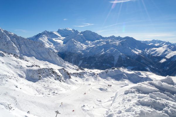
Alps Snow Forecast: Up to 64 cm Headed for the High Glaciers as the Snow Line Drops
The Alps are about to swap mild, sunny October weather for something far more wintry. A cold front arrives Tuesday, and SnowStash forecasts have Monterosa Ski out in front with 64 cm over 14 days, ahead of Blatten Belalp (55 cm) and Verbier (43 cm). The snow line should fall below 2000 metres by Wednesday night, and glaciers across Switzerland, Italy and Austria are in line for the best of it. The wind will have a say too.
20 Oct 2026
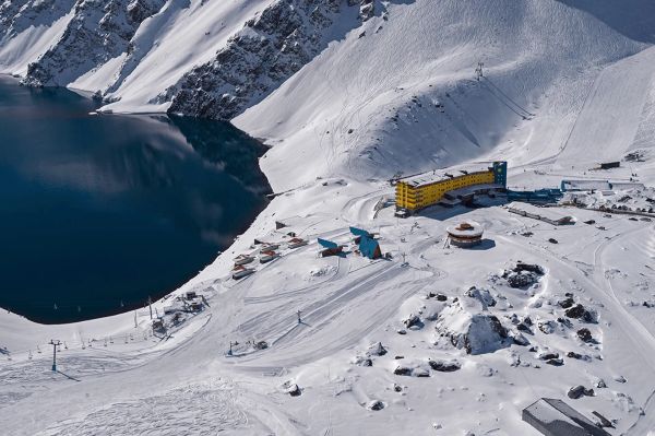
Four Dead After Avalanche Near Ski Portillo in Chile
A large avalanche struck near Laguna del Inca adjacent to Ski Portillo on Saturday afternoon, killing four people and injuring four others. The group were day visitors mountaineering in the backcountry after reportedly being warned about elevated avalanche risk by resort staff.
18 Oct 2026

Europe Ski Resorts Open Now: What Is Skiable in Mid-October 2026
Europe’s ski season is open, technically. After a record-warm summer, glaciers in Austria, Switzerland and Italy are running a few pistes apiece, Sölden, Stubai and Kitzsteinhorn started late, Titlis has pushed back to 24 October, and Zermatt reopens a few lifts on 14 October after more than two months shut. Finland’s Levi and Ruka are skiing on stored snow. Here is what is open, and what you actually get at each.
14 Oct 2026

Zermatt Plans World Cup Downhill Return on the Gornergrat for 2028
Zermatt is having another crack at a World Cup downhill, and this time nobody has to cross a border. Around 13 million Swiss francs is going into rebuilding the Gornergrat piste, including a jump fed by a roughly 300-metre in-run across the roof of the Gornergrat Railway gallery, with the Matterhorn lined up behind it for the TV cameras. First men’s race is pencilled in for March 2028, pending FIS homologation.
14 Oct 2026

Mt. Rose Begins Snowmaking for the 2026-27 Season at Lake Tahoe
Lake Tahoe’s highest base elevation is paying off early: Mt. Rose has started making snow for 2026-27 after the first flurries and a cold snap. The Nevada resort is backing it with nearly US$2 million in upgrades, including a replacement snowmaking main line, a new PistenBully groomer and restraint bars on every lift. Opening day is yet to be confirmed, though Heavenly and Northstar are already eyeing 20 November.
13 Oct 2026

Utah Ski Resorts 2026-27: What’s New at Alta, Deer Valley, Powder Mountain and More
Utah is still building flat out. For 2026-27, Powder Mountain opens a steep new Skytrac chair into more than 1,000 acres of advanced terrain, Deer Valley adds 200 acres on Hail Peak, Sundance gets a new quad and Park City adds a gondola from its new parking structure. Snowmaking is expanding almost everywhere, Eagle Point stays closed after the Cottonwood Fire, and the 2034 Games are setting the pace. Here’s what’s new, resort by resort.
13 Oct 2026

Mt Hutt Invests NZ$12 Million in Base Area, Tripling Its Sun Deck
Mt Hutt is getting busier, and its base lodge is about to catch up. NZ$12 million goes into a heated sun deck roughly three times the current size (430 m² to 1,300 m²), plus a new toilet block, heated steps down to snow level, extra storage and a new food and beverage outlet. Building starts after the 2026 season, with everything due for winter 2027.
11 Oct 2026

Vermont Ski Resort Opening Dates 2026-27: Few Dates Set, Killington Waits on the Cold
Vermont's season is slow to take shape. Stratton is tentatively targeting 18 November and Sugarbush 21 November, while Pico has Friday 11 December on the calendar. Killington never sets a date and opens when the snowmaking allows, and Vail Resorts has yet to name days for Stowe, Okemo and Mount Snow. The forecasts disagree about snow, and the main El Niño worry for the Green Mountains is warmth.
9 Oct 2026