
Whakapapa
Ski 550 hectares of volcanic terrain from 1,630–2,300m on Mt Ruapehu, with NZ's best beginner area and the Sky Waka gondola.
Season 2026
Opens
27 June 2026
Closes
11 Oct 2026
Days open
106
Annual snow
4m
The Overview
Michael Fulton
Melbourne-based skier and snowboarder with 50+ resorts across 5 continents. Specialises in Australian resorts and international resort comparisons.
Whakapapa spans 550 hectares on the north-western slopes of Mt Ruapehu, an active 2,797m volcano at the heart of Tongariro National Park — a dual UNESCO World Heritage site on New Zealand's North Island. The ski field rises from 1,630m to 2,300m with a 690m vertical drop across 67 runs graded 30% beginner, 45% intermediate, 20% advanced and 5% expert.
The terrain is shaped by the mountain's volcanic geology — old lava flows, natural gullies and rock-formed halfpipes create a riding landscape unlike any other ski area in the country. Advanced and expert lines around the Amphitheatre, the Pinnacles and the Waterfall Express deliver steep faces and technical freeride across raw volcanic topography.
Happy Valley, a dedicated beginner zone separated from the main ski field in its own sheltered valley, is widely regarded as the best learner facility in New Zealand. The progression from Happy Valley through the Rangatira chairlift zone to the upper mountain is well structured for developing skiers.
Since 2025, Whakapapa has been operated by Whakapapa Holdings under a ten-year Department of Conservation concession. The ski area has deep roots in New Zealand's skiing history — the first skiers reached Ruapehu's slopes in 1913, and organised lift-served skiing has operated here since the 1950s.
670m
Vertical
67
Runs
1,359 acres
Skiable
4m
Annual snow
The Terrain
67 runs across 1,359 acres skiable
Whakapapa is the larger of Mt Ruapehu's two commercial fields, covering about 550 hectares across the north-western slopes of Mt Ruapehu in Tongariro National Park. The field falls 670 metres, from 2,300 to 1,630 metres, over 67 runs. Sanity has the split at 30% beginner, 45% intermediate, 20% advanced and 5% expert, so this is the friendlier of the two Ruapehu commercial fields. Old lava flows, gullies and ridges break the mountain into distinct sectors rather than one uniform face. A gondola, quad and triple chairs, T-bars and magic carpets move skiers around twelve lifts.
Happy Valley, a sheltered beginner zone with its own chairlift, is where most newcomers start, and intermediates then spread across wide groomed runs on the middle mountain. Stronger skiers head for the upper slopes, where steep chutes, huge basins and natural volcanic features reward some exploring, and the Black Magic backcountry area is reached by traversing or hiking from the Far West T-bar. Treat that terrain with care, because it is not patrolled like the pistes. Whakapapa suits mixed groups, families and developing intermediates who want a big, varied volcano with room to progress.
Terrain split
67
runs
67 runs across 4 grades
Beginner20 runs · 30%
Intermediate30 runs · 45%
Advanced13 runs · 20%
Expert3 runs · 5%
Time it right
When to visit Whakapapa
Whakapapa operates from late June through to Labour Weekend in October, with the 2026 season running from 27 June to 11 October. Sightseeing, sledding and snow play via the Sky Waka gondola open earlier from 30 May, with full ski operations commencing on 27 June as the snow base builds.
Peak conditions typically fall between mid-July and September, with the deepest base depths through August. The mountain's North Island location means weather systems can bring rapid changes, and the exposed volcanic terrain above the treeline leaves upper lifts susceptible to wind closures more frequently than sheltered South Island resorts.
Spring skiing through September and into October is popular with locals, offering warmer days and clear Central Plateau skies. Visitors should check the daily snow report before making the drive, as conditions on Ruapehu can shift significantly within hours.
The combination of high natural snowfall and a season stretching into mid-October gives Whakapapa one of the longer operating windows of any non-glacier resort in New Zealand — particularly notable given the mountain receives no significant snowmaking support on the upper runs.
Season 2026
27 June 2026
Opens
11 Oct 2026
Closes
106
Days open
4 m
Annual snow
Getting there
Getting to Whakapapa, and where to stay
Whakapapa sits within Tongariro National Park, accessed via Bruce Road — a 6km sealed road from Whakapapa Village at the base of the mountain. The village is home to the heritage-listed Chateau Tongariro, and 47 ski club lodges along the mountain road provide on-mountain accommodation during the season.
The nearest towns are National Park Village (15 minutes) and Ohakune (approximately one hour via highway). As a North Island resort, Whakapapa draws from the major population centres: roughly 3 hours from Hamilton, 4 from Wellington and 5 from Auckland.
There is no major airport nearby. Taupo (one hour) and Rotorua (two hours) offer regional domestic connections. International visitors typically fly into Auckland or Wellington and drive, or connect via Taupo. Shuttle services operate during the season from surrounding towns.
The Tongariro National Park setting places the resort within a protected conservation landscape of significant cultural importance to Māori. The volcanic environment creates one of the most visually dramatic ski backdrops in the world — the view from the upper mountain takes in the Tongariro Alpine Crossing, the steaming cone of Ngauruhoe and the Central Plateau stretching to the horizon.
Where to stay
Search all stays →Hotels and lodges near Whakapapa, powered by Stay22.
Latest News
From the SnowStash desk
Alps Snow Forecast: Up to 64 cm Headed for the High Glaciers as the Snow Line Drops
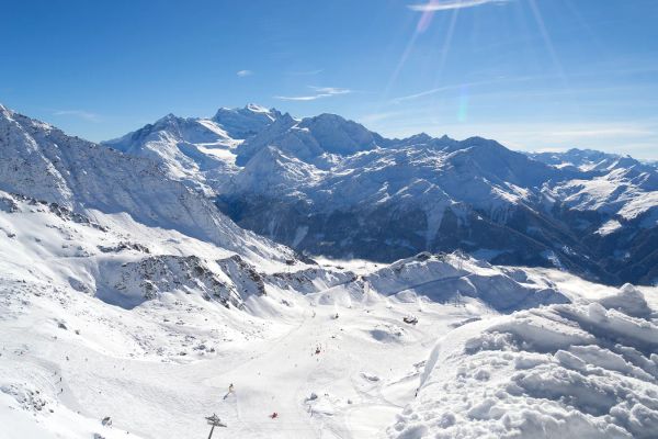
The Alps are about to swap mild, sunny October weather for something far more wintry. A cold front arrives Tuesday, and SnowStash forecasts have Monterosa Ski out in front with 64 cm over 14 days, ahead of Blatten Belalp (55 cm) and Verbier (43 cm). The snow line should fall below 2000 metres by Wednesday night, and glaciers across Switzerland, Italy and Austria are in line for the best of it. The wind will have a say too.
20 Oct 2026
Four Dead After Avalanche Near Ski Portillo in Chile
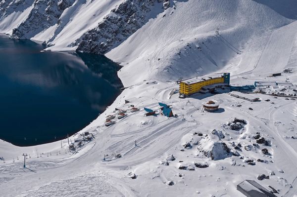
A large avalanche struck near Laguna del Inca adjacent to Ski Portillo on Saturday afternoon, killing four people and injuring four others. The group were day visitors mountaineering in the backcountry after reportedly being warned about elevated avalanche risk by resort staff.
18 Oct 2026

Europe Ski Resorts Open Now: What Is Skiable in Mid-October 2026
Europe’s ski season is open, technically. After a record-warm summer, glaciers in Austria, Switzerland and Italy are running a few pistes apiece, Sölden, Stubai and Kitzsteinhorn started late, Titlis has pushed back to 24 October, and Zermatt reopens a few lifts on 14 October after more than two months shut. Finland’s Levi and Ruka are skiing on stored snow. Here is what is open, and what you actually get at each.
14 Oct 2026

Zermatt Plans World Cup Downhill Return on the Gornergrat for 2028
Zermatt is having another crack at a World Cup downhill, and this time nobody has to cross a border. Around 13 million Swiss francs is going into rebuilding the Gornergrat piste, including a jump fed by a roughly 300-metre in-run across the roof of the Gornergrat Railway gallery, with the Matterhorn lined up behind it for the TV cameras. First men’s race is pencilled in for March 2028, pending FIS homologation.
14 Oct 2026

Mt. Rose Begins Snowmaking for the 2026-27 Season at Lake Tahoe
Lake Tahoe’s highest base elevation is paying off early: Mt. Rose has started making snow for 2026-27 after the first flurries and a cold snap. The Nevada resort is backing it with nearly US$2 million in upgrades, including a replacement snowmaking main line, a new PistenBully groomer and restraint bars on every lift. Opening day is yet to be confirmed, though Heavenly and Northstar are already eyeing 20 November.
13 Oct 2026

Utah Ski Resorts 2026-27: What’s New at Alta, Deer Valley, Powder Mountain and More
Utah is still building flat out. For 2026-27, Powder Mountain opens a steep new Skytrac chair into more than 1,000 acres of advanced terrain, Deer Valley adds 200 acres on Hail Peak, Sundance gets a new quad and Park City adds a gondola from its new parking structure. Snowmaking is expanding almost everywhere, Eagle Point stays closed after the Cottonwood Fire, and the 2034 Games are setting the pace. Here’s what’s new, resort by resort.
13 Oct 2026

Mt Hutt Invests NZ$12 Million in Base Area, Tripling Its Sun Deck
Mt Hutt is getting busier, and its base lodge is about to catch up. NZ$12 million goes into a heated sun deck roughly three times the current size (430 m² to 1,300 m²), plus a new toilet block, heated steps down to snow level, extra storage and a new food and beverage outlet. Building starts after the 2026 season, with everything due for winter 2027.
11 Oct 2026

Vermont Ski Resort Opening Dates 2026-27: Few Dates Set, Killington Waits on the Cold
Vermont's season is slow to take shape. Stratton is tentatively targeting 18 November and Sugarbush 21 November, while Pico has Friday 11 December on the calendar. Killington never sets a date and opens when the snowmaking allows, and Vail Resorts has yet to name days for Stowe, Okemo and Mount Snow. The forecasts disagree about snow, and the main El Niño worry for the Green Mountains is warmth.
9 Oct 2026
Whakapapa Snow Report
Snow Report
Updated 22 Oct 2026
2300m
summit
+0cm
new snow · last 24 hours
Clear1°C / 10°C · N 11km/h
Snowfall
24 hours
0cm
48 hours
0cm
7 days
0cm
Base depth
0cm
Season total
0cm
Total lifts13
Live open status isn’t available right now.
27 June 2026 - 11 Oct 2026
Hour by Hour
Next 48 hours· Updated Oct 23, 2026 at 6:02 PM
Scroll for the full outlook · Open-Meteo
7-Day Outlook
2,300 mUpdated Oct 23, 2026 at 6:02 PMOpen-Meteo
Days 1–7
0.4cm
Days 8–14
3.6cm
Fri, Oct 23
Foggy
Temp10° / 1°°C
Snow0.0cm(8%)
Wind11 km/h N
Live snow from the resort feed; forecast from Open-Meteo, via Supabase.
Understanding the Whakapapa snow report
Get the latest Whakapapa snow report — real-time snowfall, snow depth, and mountain weather for this North Island resort, spanning 1630m to 2300m in elevation.
Snow measurements
Our snow reports measure snowfall in centimeters over multiple time windows — last 24 hours, last 7 days, and the season total. Base depth reflects accumulation at the 1630m base area, while summit depth captures conditions 670m higher at 2300m, where snow typically stays colder and lingers longer. Imperial conversions are shown alongside for convenience.
Weather conditions
Current weather conditions affect snow quality. Cold temperatures with low wind typically preserve snow quality, while warm temperatures or rain can impact conditions negatively — something worth watching closely at Whakapapa's 1630m base elevation, where temperatures run milder than the summit.
Data sources
Snowfall and depth figures for Whakapapa come from official mountain sources; weather and outlook data comes from independent forecasting services. The mountain is served by 13 lifts, including 3 quad chairlifts and a gondola.
When to check
The biggest swings usually happen right after a storm. Check Whakapapa's report in the morning for the freshest numbers, and again in the afternoon as conditions evolve.