
Major Snowfall Forecast for Australian Ski Resorts: What Riders Need to Know
Published Date:

Melbourne-based skier and snowboarder with 50+ resorts across 5 continents. Specialises in Australian resorts and international resort comparisons.

Substantial Snowfall Headed for Australian Alps
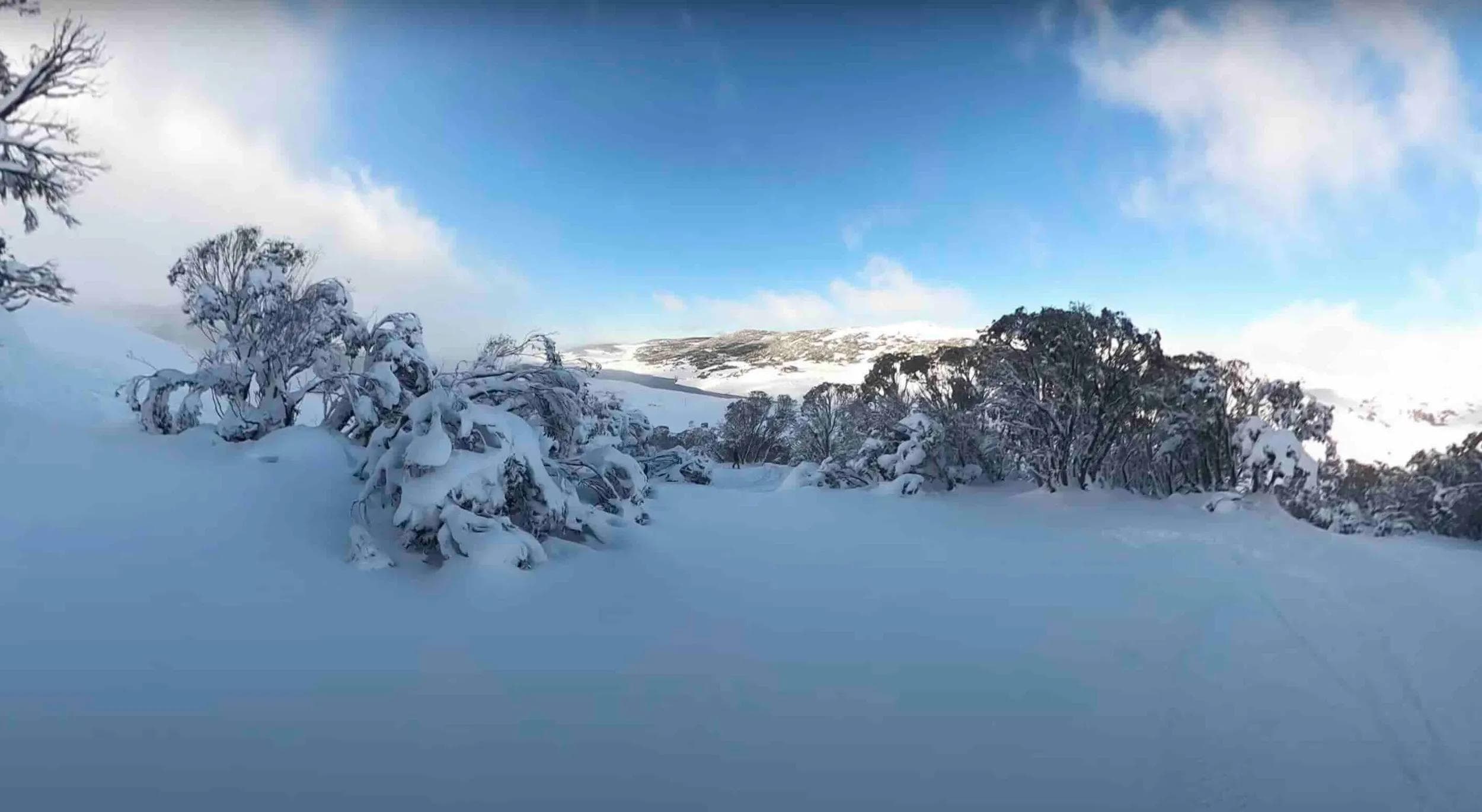
Australian ski resorts are bracing for a significant weather event this week, with forecasts predicting up to 90cm of snow for some areas. This system looks to favour the Snowy Mountains and Victorian High Country, potentially delivering much-needed coverage as the southern hemisphere ski season progresses. However, as with any forecast of this magnitude, there are several factors skiers and riders should consider before getting too excited.
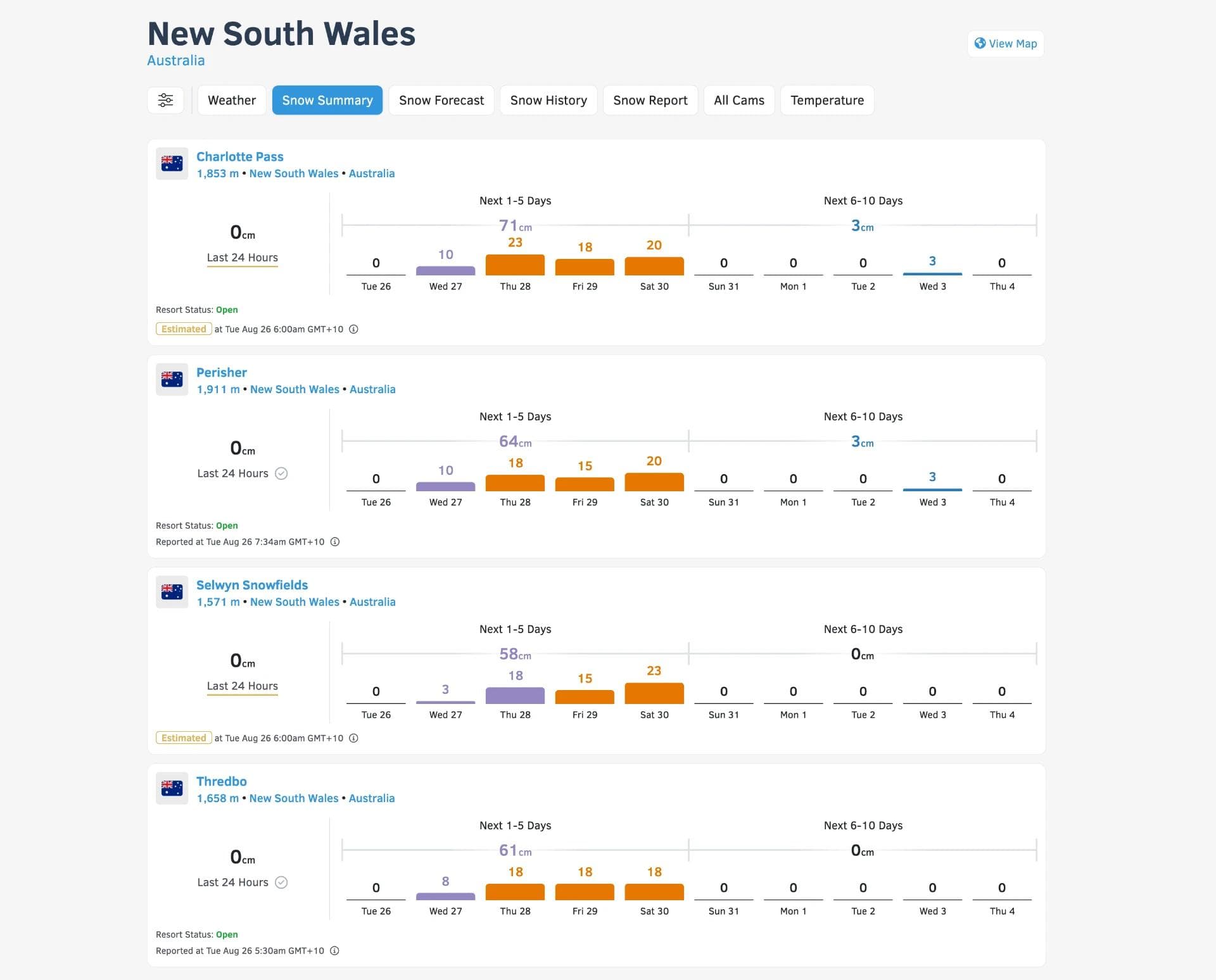
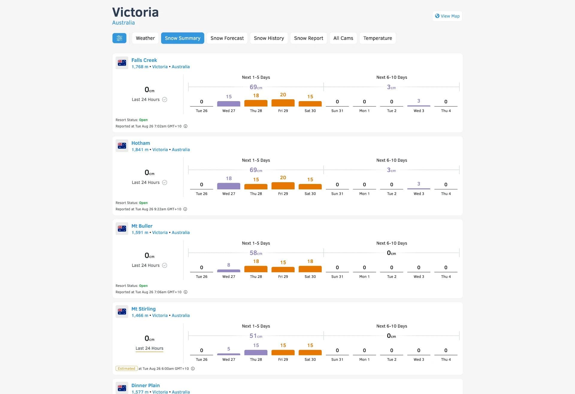
The cold front is expected to hit late in the week, with the heaviest snowfall predicted for Friday night. Resorts in the Snowy Mountains, including Charlotte Pass, Thredbo, Perisher, and Selwyn, could see storm totals of 45-75cm. Victorian resorts aren't far behind, with Falls Creek and Mount Hotham potentially receiving 66-70cm, and Mount Buller around 66cm. Lower-elevation areas like Mount Baw Baw and Tasmania's Mount Mawson are likely to see lesser amounts.
While the headline numbers are impressive, it's crucial to understand the nuances of this system. The storm is set to evolve in stages, each with distinct characteristics that will affect snow quality and skiing conditions:
- Tuesday night to Thursday night: The initial wave will bring warmer, denser snow with snow levels starting high (around 1,645m) before dropping to 1,100-1,250m. This means potential rain or mixed precipitation at lower elevations, particularly at resorts like Thredbo and Selwyn. Accumulations during this period could reach 25-48cm for most mainland resorts.
- Friday to Friday night: This is when the real cold air arrives, dropping snow levels to 790-915m. Snow quality should improve with snow-to-liquid ratios increasing to 9-11:1. Most resorts could see an additional 25-30cm during this period, with some standouts potentially receiving more.
- Saturday to Sunday: The system begins to taper off, but snow showers could add a few more centimetres of relatively dry snow. However, a mild bump in temperatures on Sunday will raise snow levels again to 1,460-1,520m, potentially bringing mixed precipitation back to lower elevations.
It's worth noting that strong, gusty winds are expected on exposed ridges, which could lead to wind holds on lifts at times. This may impact access to some of the best snow, particularly during the peak of the storm.
While this forecast is certainly promising for Australian ski resorts, it's important to approach it with measured expectations. The varying snow levels and densities throughout the event mean that snow quality and coverage will be inconsistent across elevations and aspects. Lower resorts and base areas may struggle with mixed precipitation and less accumulation, while higher terrain should fare better.
For skiers and riders planning trips around this system, flexibility will be key. The best conditions are likely to be found on Saturday, after the heaviest snowfall but before temperatures rise again on Sunday. However, wind holds could complicate access to the best terrain.
In the broader context of the Australian ski season, this storm could provide a significant boost to snow depths, potentially setting up resorts for improved conditions through the latter part of the season. However, it's worth remembering that Australian snow conditions can be notoriously variable, and one good storm doesn't guarantee a stellar season.
Ultimately, while this forecast offers reason for optimism, skiers and riders should temper their excitement with pragmatism. Keep an eye on evolving forecasts, be prepared for changing conditions, and as always in the Australian Alps, hope for the best but plan for a range of scenarios.