
Mürren Schilthorn
54km piste, 2174m vertical, 2970m summit. Car-free Bernese Oberland village with Jungfrau pass access. 15 Nov-20 Apr 2026.
Season 2026 - 2027
Opens
7 Nov 2026
Closes
2 May 2027
Days open
176
Annual snow
10m
The Overview
Michael Fulton
Melbourne-based skier and snowboarder with 50+ resorts across 5 continents. Specialises in Australian resorts and international resort comparisons.
The ski area spans 796 to 2970 metres across the Schilthorn massif above the Lauterbrunnen valley. 54 kilometres of piste and 24 marked runs deliver 2174 metres of vertical drop, the highest ski terrain in the Bernese Oberland. The Jungfrau Ski Region pass grants access to 206 kilometres across Mürren, Wengen, Männlichen and Grindelwald-First, with train travel from Interlaken Ost included.
Terrain splits 35% beginner, 43% intermediate, 15% advanced and 7% expert. The Allmendhubel funicular accesses gentle slopes ideal for first turns, whilst the Schiltgrat and Winteregg quad chairs serve long groomed cruisers. Run 9, the Direttissima from Birg, pitches at 88% gradient and ranks as the steepest marked piste in the Jungfrau Region. The 14.9-kilometre Inferno course from below Piz Gloria to Lauterbrunnen traces the route of the world's largest amateur downhill race, held each January since 1928 with 1850 competitors.
The car-free village of Mürren sits at 1638 metres on a clifftop terrace, accessible only by cable car and mountain railway from Lauterbrunnen or Stechelberg. Twelve mountain restaurants dot the ski area, including the revolving Piz Gloria at the 2970-metre Schilthorn summit, filming location for the 1969 James Bond film On Her Majesty's Secret Service. The Pända Snowpark at Maulerhubel offers kickers, rails and boxes for freestylers, whilst freeriders access steep couloirs and open bowls above Birg.
The resort suits confident intermediates and advanced skiers seeking verticality and high-altitude snow reliability. Families benefit from Mürren's traffic-free environment and dedicated beginner zones, though the terrain quickly becomes challenging. The Jungfrau Ski Region pass opens three neighbouring ski areas within a single day, making this a strategic base for exploring the Bernese Oberland's interconnected lift network across five to seven days.
2174m
Vertical
24
Runs
54 km
Piste
10m
Annual snow
Watch
See Mürren Schilthorn in motion
The Terrain
24 runs across 54 km of piste
Mürren Schilthorn drops a dramatic 2,174 metres, from the 2,970-metre Schilthorn to a valley base at 796 metres, across 24 runs and 54 kilometres. The terrain is varied, at 35% beginner, 43% intermediate, 15% advanced and 7% expert. Six aerial trams, a train and a handful of chairs make up the lift network, and around 10 metres of snow falls each year, so the top slopes get regular refreshment. This is a high-contrast mountain rather than a large lift-linked circuit, where a single day can span nursery slopes, groomed cruising and some of the steepest marked pistes in the Bernese Oberland.
The Inferno, a roughly 15-kilometre amateur downhill from the Schilthorn to Lauterbrunnen, runs each January and shapes how many skiers think of the area. Visitors can ski the upper slopes around Piz Gloria, the revolving restaurant made famous by the 1969 Bond film, while the Allmendhubel side offers gentler terrain and the Pända snowpark sits at Maulerhubel. Experts and strong intermediates will enjoy the length and steep pitches, and learners have nursery terrain near Mürren. Car-free access and a quiet village atmosphere suit skiers who prefer character over size.
Terrain split
24
runs
24 runs across 4 grades
Beginner8 runs · 35%
Intermediate10 runs · 43%
Advanced4 runs · 15%
Expert2 runs · 7%
Time it right
When to visit Mürren Schilthorn
The 2025-26 season runs from 15 November 2025 to 20 April 2026, spanning 22 weeks. Mürren-Schilthorn typically opens mid-November and maintains upper-mountain skiing through late April, benefiting from altitude that reaches nearly 3000 metres. The broader Jungfrau Ski Region operates from 15 November to 26 April across its four interconnected areas, with slight variations in opening and closing dates between sectors.
Annual snowfall averages 10 metres, with the upper Birg-Schilthorn zone remaining snow-sure into spring due to elevation and north-facing aspects. March delivers peak accumulation and longer daylight, averaging 112 centimetres at the summit and 30 centimetres at base elevations. Snowmaking covers 15 kilometres of lower runs, supported by 38 cannons concentrated around Mürren village and Winteregg. Natural snow dominates the upper mountain, where steep terrain and exposure render snowmaking impractical.
January brings the Inferno race week from 21-24, drawing 1850 amateur competitors and transforming the quiet village into a four-day winter sports festival. The race starts below the Schilthorn summit, descends through the Engetal and Kanonenrohr sections, crosses the Winteregg Bridge and finishes in Lauterbrunnen after 2170 metres of vertical. December through February offers the most reliable snow cover and coldest temperatures, whilst March and April provide spring conditions with softer snow and stronger sun.
The Swiss Snow Happening telemark event occupies 8-11 April 2026, and mid-season coincides with the Lauberhorn races in neighbouring Wengen, creating regional buzz in mid-January. Quieter periods fall in early December before Christmas holidays and late January through mid-February outside school breaks. Night skiing is not offered, though the Schilthornbahn operates until 16:00 for summit dining and sightseeing.
Season 2026 - 2027
7 Nov 2026
Opens
2 May 2027
Closes
176
Days open
10 m
Annual snow
Getting there
Getting to Mürren Schilthorn, and where to stay
Mürren occupies a mountain terrace on the western flank of the Lauterbrunnen valley in the Bernese Oberland, Canton Bern. The car-free village perches at 1638 metres on a cliff edge, 800 metres above the valley floor, facing the Eiger, Mönch and Jungfrau massif across the gorge. The Schilthorn peak rises 1332 metres directly above to 2970 metres, forming the western boundary of the Jungfrau Region and the highest ski terrain in the Bernese Alps' northern range.
Lauterbrunnen sits in the valley eight kilometres south of Interlaken, serving as the road-head and railway terminus for Mürren-bound visitors. Interlaken lies 12 kilometres north along the valley road, a 20-minute drive or 20-minute train journey from Lauterbrunnen station. Stechelberg, three kilometres further up-valley from Lauterbrunnen, hosts the alternative cable car base station for the Schilthornbahn. The region sits in central Switzerland roughly midway between Bern and Lucerne.
By road, the A8 motorway from Bern reaches Interlaken in one hour, whilst Zurich lies two hours northeast via the A1 and A8. Geneva sits three hours west via the A1 through Bern, and Basel two hours north via the A2 and A8. From Interlaken, Route 11 runs south through Wilderswil to Lauterbrunnen, passing Zweilütschinen where the valley forks towards Grindelwald. Parking in Lauterbrunnen costs 17 Swiss francs per 24 hours in the multi-storey below the station; Stechelberg parking runs 11 francs daily.
Zurich Airport sits 149 kilometres and two hours' drive northeast; direct trains run every two hours to Interlaken Ost, connecting to Lauterbrunnen in 20 minutes. Bern Airport lies 66 kilometres and one hour by road, though rail connections require a bus transfer to Bern station. Geneva Airport sits 171 kilometres and two hours' drive, with trains connecting via Bern in approximately three hours. From Lauterbrunnen, passengers take either the Grütschalp cable car and BLM train to Mürren's north end, or the Stechelberg cable car to Mürren's south end, each route requiring 20-30 minutes.
Where to stay
Search all stays →Hotels and lodges near Mürren Schilthorn, powered by Stay22.
Latest News
From the SnowStash desk

Europe Ski Resorts Open Now: What Is Skiable in Mid-October 2026
Europe’s ski season is open, technically. After a record-warm summer, glaciers in Austria, Switzerland and Italy are running a few pistes apiece, Sölden, Stubai and Kitzsteinhorn started late, Titlis has pushed back to 24 October, and Zermatt reopens a few lifts on 14 October after more than two months shut. Finland’s Levi and Ruka are skiing on stored snow. Here is what is open, and what you actually get at each.
14 Oct 2026

Zermatt Plans World Cup Downhill Return on the Gornergrat for 2028
Zermatt is having another crack at a World Cup downhill, and this time nobody has to cross a border. Around 13 million Swiss francs is going into rebuilding the Gornergrat piste, including a jump fed by a roughly 300-metre in-run across the roof of the Gornergrat Railway gallery, with the Matterhorn lined up behind it for the TV cameras. First men’s race is pencilled in for March 2028, pending FIS homologation.
14 Oct 2026

Mt. Rose Begins Snowmaking for the 2026-27 Season at Lake Tahoe
Lake Tahoe’s highest base elevation is paying off early: Mt. Rose has started making snow for 2026-27 after the first flurries and a cold snap. The Nevada resort is backing it with nearly US$2 million in upgrades, including a replacement snowmaking main line, a new PistenBully groomer and restraint bars on every lift. Opening day is yet to be confirmed, though Heavenly and Northstar are already eyeing 20 November.
13 Oct 2026

Utah Ski Resorts 2026-27: What’s New at Alta, Deer Valley, Powder Mountain and More
Utah is still building flat out. For 2026-27, Powder Mountain opens a steep new Skytrac chair into more than 1,000 acres of advanced terrain, Deer Valley adds 200 acres on Hail Peak, Sundance gets a new quad and Park City adds a gondola from its new parking structure. Snowmaking is expanding almost everywhere, Eagle Point stays closed after the Cottonwood Fire, and the 2034 Games are setting the pace. Here’s what’s new, resort by resort.
13 Oct 2026

Mt Hutt Invests NZ$12 Million in Base Area, Tripling Its Sun Deck
Mt Hutt is getting busier, and its base lodge is about to catch up. NZ$12 million goes into a heated sun deck roughly three times the current size (430 m² to 1,300 m²), plus a new toilet block, heated steps down to snow level, extra storage and a new food and beverage outlet. Building starts after the 2026 season, with everything due for winter 2027.
11 Oct 2026

Vermont Ski Resort Opening Dates 2026-27: Few Dates Set, Killington Waits on the Cold
Vermont's season is slow to take shape. Stratton is tentatively targeting 18 November and Sugarbush 21 November, while Pico has Friday 11 December on the calendar. Killington never sets a date and opens when the snowmaking allows, and Vail Resorts has yet to name days for Stowe, Okemo and Mount Snow. The forecasts disagree about snow, and the main El Niño worry for the Green Mountains is warmth.
9 Oct 2026
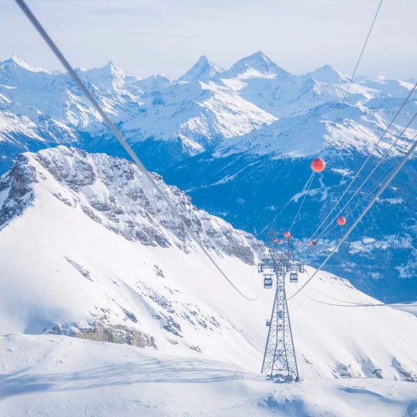
Crans-Montana 2027 World Championships President Resigns Ahead of Fraud Hearing
Less than four months out from the Crans-Montana 2027 World Championships, the man running the organising committee has stepped down. Claude-Alain Schmidhalter resigned as Swiss-Ski vice president and OC president after being indicted over a business dispute unrelated to skiing. He denies the allegations and faces court on October 27. Interim leaders are in place for the February 1-14 event.
9 Oct 2026
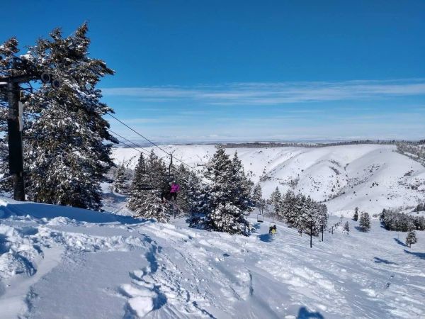
Kelly Canyon, Idaho, Adds Snowmaking, a Bigger Terrain Park and More Parking for 2026-27
Kelly Canyon had a rough 2025-26, and the Idaho resort has spent the summer making sure it doesn’t repeat. Snowmaking now reaches the top of Goldrush, the terrain park is doubling in size with a stereo system, lights and a snack shack, and the car park is getting bigger. Grooming is stepping up too. Target opening is December 4, conditions permitting.
9 Oct 2026