
Mt Olympus
4.5m annual snowfall, 60 hectares, rope tows, groomer-free terrain. Club field 130km from Christchurch, New Zealand.
Season 2026
Opens
26 July 2026
Closes
27 Sept 2026
Days open
63
Annual snow
4m
The Overview
Michael Fulton
Melbourne-based skier and snowboarder with 50+ resorts across 5 continents. Specialises in Australian resorts and international resort comparisons.
Mt Olympus operates at elevations between 1430 and 1880 metres with 450 metres of vertical drop across 60 hectares of skiable terrain. The field offers 18 runs split 10 per cent beginner, 55 per cent intermediate and 35 per cent advanced, with a south-facing basin positioned to capture southerly powder dumps that deliver over 4.5 metres of snowfall annually. The 2096-metre Mt Olympus peak towers above the ski area, which sits in a high basin at the southern end of the Craigieburn Range. Bluffed ridges to the north, west and east shelter the mountain from prevailing westerly winds, helping it hold snow when other Canterbury fields get stripped.
The terrain unfolds across a groomer-free bowl of schist and shale that demands off-piste skills. Four rope tows service lift-accessed terrain, whilst short hikes from the top tow open routes to Little Alaska, The Sphinx, Ardi's Peak and the Back Ridge. The treeless basin suits confident intermediates who can read ungroomed snow, whilst advanced terrain includes steep chutes and couloirs that attract New Zealand's freeride community. Daily skier numbers rarely exceed 100, ensuring fresh tracks remain available hours after a snowfall.
Mt Olympus has operated as a club field under the Windwhistle Winter Sports Club since 1932, with volunteer members maintaining infrastructure and running operations. The Top Hut at 1640 metres offers ski-in ski-out accommodation for up to 52 guests, complete with communal dining, a drying room and the Far Canal Bar. Day trippers access the lodge via an access rope tow from the car park, whilst the field maintains a relaxed clubbie atmosphere where regulars share local knowledge. Night skiing runs on select dates when conditions permit.
Season passes for club members who contribute 10 or more work days cost NZ$200, whilst non-member daily passes run NZ$104 regular and NZ$120 peak. Children under 10 ski free, and the field operates independently without ties to multi-mountain pass networks. The 2026 season runs 26 July to 27 September, typical of club fields that open later than commercial areas. Mt Olympus suits backcountry-oriented skiers who value powder quality and solitude over grooming and high-speed lifts, with avalanche safety equipment compulsory for all hiking beyond patrolled terrain.
450m
Vertical
18
Runs
148 acres
Skiable
4m
Annual snow
The Terrain
18 runs across 148 acres skiable
Mt Olympus is a small club-style ski field in the Craigieburn Range of Canterbury, with about 60 hectares of skiable ground in a south-facing basin. The 450-metre vertical runs from 1,430 to 1,880 metres across 18 runs, split 10% beginner, 55% intermediate and 35% advanced. There is no expert category. Visitors should know that this is a remote mountain: the shingle access road is steep, narrow towards the top and needs chains and a capable 4WD in poor conditions. Once on snow, the reward is a quiet, natural-feeling field with few other people sharing it.
Surface lifts carry skiers high up the basin, and the upper slopes open into wide, rolling terrain with a choice of lines from the Main Tow and Top Tow areas. Intermediates make up more than half the mountain, so most competent skiers will find comfortable runs, while the advanced 35% covers the steeper pitches above and beside them. Beginners are a small group here, and rope-tow style lifts reward some prior experience. Mt Olympus suits adventurous intermediates and advanced skiers who value solitude and character over facilities and groomed convenience.
Terrain split
18
runs
18 runs across 4 grades
Beginner2 runs · 10%
Intermediate10 runs · 55%
Advanced6 runs · 35%
Expert0 runs · 0%
Time it right
When to visit Mt Olympus
The 2026 season opens 26 July and closes 27 September, spanning nine weeks within New Zealand's typical club field window. Mt Olympus missed the entire 2020 season due to COVID-19 restrictions and insufficient snow, the first closure since 1978, whilst access road damage in 2021 threatened a second consecutive lost season before community fundraising enabled repairs. Operating dates depend on snowpack development and road access rather than fixed commercial schedules, with the club announcing opening once conditions stabilise. Spring skiing often extends into October during high-snow years, thanks to the basin's south-facing aspect and snow retention.
Annual snowfall averages 4.5 metres, delivered primarily by southerly storms tracking from Antarctica that the basin's topography traps efficiently. The south-facing alignment captures powder that bypasses west-facing fields exposed to nor'west winds, whilst high ridges on three sides create a natural snow pocket. No snowmaking exists on the mountain, and grooming is entirely absent by philosophy rather than budget, making natural snowfall the sole determinant of surface quality. Base depths build steadily through July and August, with the field holding snow when exposed areas get stripped by wind.
Mid-winter months from late July through August deliver the most consistent powder, with storms rolling through every week during active patterns. September brings longer daylight and spring corn conditions as temperatures rise, particularly on sun-exposed slopes that soften by midday. Quieter periods occur midweek outside school holidays, when overnight guests and committed locals dominate the mountain. Peak powder days after major southerly dumps draw larger crowds, though 100 skiers still constitutes a busy day compared to commercial fields that host thousands.
Night skiing operates on select evenings when conditions and bookings align, requiring advance reservations through the club. The season calendar includes designated ski weeks targeting different demographics, from Wrinkle Free weeks for younger crowds to family-oriented programmes. No major competitions or festivals anchor the calendar, keeping the focus on pure skiing and lodge-based socialising. Weather variability remains high across all Canterbury fields, meaning no single week guarantees conditions, though February storms historically deliver the deepest accumulations before the season opens.
Season 2026
26 July 2026
Opens
27 Sept 2026
Closes
63
Days open
4 m
Annual snow
Getting there
Getting to Mt Olympus, and where to stay
Mt Olympus occupies a high basin at the southern terminus of the Craigieburn Range in Canterbury's Southern Alps, 130 kilometres west of Christchurch. The ski area sits within Glenthorne Station, a working high-country sheep property accessed via unsealed roads that climb through tussock-covered river valleys. The base of the Access Tow sits at 1430 metres, whilst the surrounding peaks - including the 2096-metre Mt Olympus summit - define a south-facing amphitheatre of schist and shale. Lake Coleridge lies to the east, with views extending across the Harper and Wilberforce river valleys to the west, and the Rakaia Gorge cutting through volcanic rock formations to the south.
Methven, 23 kilometres to the southeast, serves as the primary service town for the region's ski fields. The rural settlement of 1800 residents offers accommodation, restaurants, equipment rental and supermarkets, positioned 95 kilometres west of Christchurch at 320 metres elevation on the Canterbury Plains. Windwhistle, a scattered rural locality 52 kilometres from the Bottom Hut turnoff, marks the junction where Highway 77 branches toward Lake Coleridge and the club fields. The region around Methven supports intensive arable farming on volcanic soils, with the Southern Alps rising abruptly from flat plains to alpine peaks within 30 kilometres.
State Highway 77 runs west from Christchurch to Windwhistle, then continues as Homestead Road and Harper Road to the Mt Olympus access gate. The sealed road ends 11.5 kilometres before the Bottom Hut at 1050 metres, where a basic self-catering lodge accommodates eight when the Top Hut fills. The final 11.5-kilometre climb from Bottom Hut to the ski area car park requires high-clearance 4WD vehicles with chains, following a single-lane track that crosses private farmland. Black Diamond Safaris operates specialist club field transport for those without suitable vehicles or mountain driving experience.
Christchurch International Airport lies 130 kilometres east, a 90-minute drive under good conditions to the Bottom Hut turnoff. Rental vehicles must have adequate clearance and chain capability for the access road, though 2WD suffices for the sealed highway to the gate. No rail service reaches Methven or surrounding areas, making private vehicles or shuttle buses the only practical options. Queenstown sits 413 kilometres to the southwest, whilst Lake Tekapo lies 157 kilometres south, both requiring multi-hour drives that make Christchurch the logical gateway for international visitors targeting Canterbury club fields.
Where to stay
Search all stays →Hotels and lodges near Mt Olympus, powered by Stay22.
Latest News
From the SnowStash desk
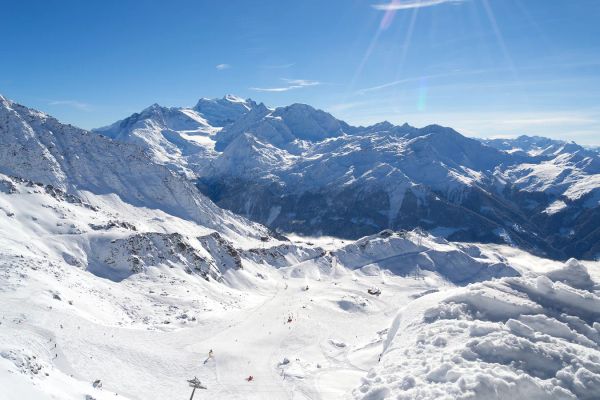
Alps Snow Forecast: Up to 64 cm Headed for the High Glaciers as the Snow Line Drops
The Alps are about to swap mild, sunny October weather for something far more wintry. A cold front arrives Tuesday, and SnowStash forecasts have Monterosa Ski out in front with 64 cm over 14 days, ahead of Blatten Belalp (55 cm) and Verbier (43 cm). The snow line should fall below 2000 metres by Wednesday night, and glaciers across Switzerland, Italy and Austria are in line for the best of it. The wind will have a say too.
20 Oct 2026
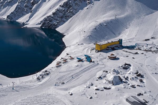
Four Dead After Avalanche Near Ski Portillo in Chile
A large avalanche struck near Laguna del Inca adjacent to Ski Portillo on Saturday afternoon, killing four people and injuring four others. The group were day visitors mountaineering in the backcountry after reportedly being warned about elevated avalanche risk by resort staff.
18 Oct 2026

Europe Ski Resorts Open Now: What Is Skiable in Mid-October 2026
Europe’s ski season is open, technically. After a record-warm summer, glaciers in Austria, Switzerland and Italy are running a few pistes apiece, Sölden, Stubai and Kitzsteinhorn started late, Titlis has pushed back to 24 October, and Zermatt reopens a few lifts on 14 October after more than two months shut. Finland’s Levi and Ruka are skiing on stored snow. Here is what is open, and what you actually get at each.
14 Oct 2026

Zermatt Plans World Cup Downhill Return on the Gornergrat for 2028
Zermatt is having another crack at a World Cup downhill, and this time nobody has to cross a border. Around 13 million Swiss francs is going into rebuilding the Gornergrat piste, including a jump fed by a roughly 300-metre in-run across the roof of the Gornergrat Railway gallery, with the Matterhorn lined up behind it for the TV cameras. First men’s race is pencilled in for March 2028, pending FIS homologation.
14 Oct 2026

Mt. Rose Begins Snowmaking for the 2026-27 Season at Lake Tahoe
Lake Tahoe’s highest base elevation is paying off early: Mt. Rose has started making snow for 2026-27 after the first flurries and a cold snap. The Nevada resort is backing it with nearly US$2 million in upgrades, including a replacement snowmaking main line, a new PistenBully groomer and restraint bars on every lift. Opening day is yet to be confirmed, though Heavenly and Northstar are already eyeing 20 November.
13 Oct 2026

Utah Ski Resorts 2026-27: What’s New at Alta, Deer Valley, Powder Mountain and More
Utah is still building flat out. For 2026-27, Powder Mountain opens a steep new Skytrac chair into more than 1,000 acres of advanced terrain, Deer Valley adds 200 acres on Hail Peak, Sundance gets a new quad and Park City adds a gondola from its new parking structure. Snowmaking is expanding almost everywhere, Eagle Point stays closed after the Cottonwood Fire, and the 2034 Games are setting the pace. Here’s what’s new, resort by resort.
13 Oct 2026

Mt Hutt Invests NZ$12 Million in Base Area, Tripling Its Sun Deck
Mt Hutt is getting busier, and its base lodge is about to catch up. NZ$12 million goes into a heated sun deck roughly three times the current size (430 m² to 1,300 m²), plus a new toilet block, heated steps down to snow level, extra storage and a new food and beverage outlet. Building starts after the 2026 season, with everything due for winter 2027.
11 Oct 2026

Vermont Ski Resort Opening Dates 2026-27: Few Dates Set, Killington Waits on the Cold
Vermont's season is slow to take shape. Stratton is tentatively targeting 18 November and Sugarbush 21 November, while Pico has Friday 11 December on the calendar. Killington never sets a date and opens when the snowmaking allows, and Vail Resorts has yet to name days for Stowe, Okemo and Mount Snow. The forecasts disagree about snow, and the main El Niño worry for the Green Mountains is warmth.
9 Oct 2026