
California Ski Resorts Set for Major Christmas Storm Cycle
Published Date:

Melbourne-based skier and snowboarder with 50+ resorts across 5 continents. Specialises in Australian resorts and international resort comparisons.
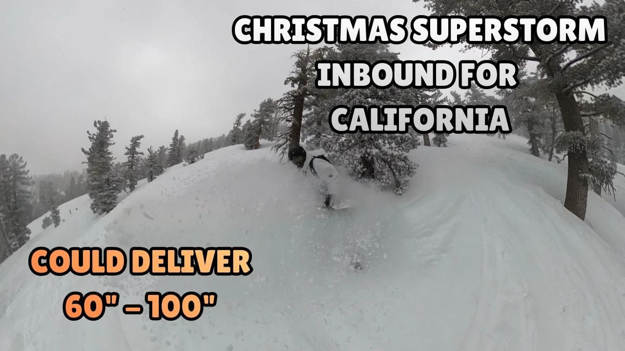
California Resorts Set for Major Christmas Storm Delivering Up to 100 Inches
After one of the driest starts to a ski season California has experienced in years, the state's ski resorts are set to receive substantial snowfall just in time for Christmas. With most resorts sitting at 1-5% terrain open and minimal base depths, this incoming storm cycle represents a complete turnaround for the season.
Current Situation Remains Challenging
According to OpenSnow data from Saturday 20 December, California's resort situation is dire. Mammoth Mountain leads at 35% open—the best-case scenario across the state. Heavenly operates at just 5% open, Northstar at 3%, and both Palisades Tahoe and Kirkwood sit at 1% despite Kirkwood's reputation as one of California's snowiest destinations.
The closed list tells an even grimmer story. Sierra-at-Tahoe, Donner Ski Ranch, Mt Shasta, Tahoe Donner, and China Peak remain completely shut. Sugar Bowl, Bear Valley, and Boreal have temporarily suspended operations while waiting for conditions to improve.
Friday afternoon brought limited relief, with wet snow falling as low as 7,000 feet before temperatures rose overnight. Mt Rose reported 5 inches by Saturday morning, while most resorts accumulated 1-3 inches on upper mountains before warmer air moved in. It's not much, but it's the first natural snow some resorts have seen in weeks.
California's MASSIVE Christmas Snow Gift: 40-100 Inches Coming This Week
Two-Phase Storm System Arrives
The incoming weather arrives in two distinct phases, each with dramatically different characteristics that will impact operations and snow quality.
Weekend Atmospheric River: Warm and Wet
An atmospheric river pushes into Northern California from Saturday afternoon, bringing challenging conditions for resort operators. Snow levels start around 8,000-8,500 feet, climbing to 9,000-9,500 feet Saturday night through Sunday evening, potentially reaching 10,000 feet—above most Tahoe resort summits.
Forecasters are calling this a "warm storm" delivering extremely wet, dense snow with ratios around 10:1 to 13:1—considerably heavier than the preferred 15:1+ powder ratios. What falls during this period will struggle to stick to anything other than existing snowpack due to warm, saturated ground conditions.
Ridge-top gusts forecast at 75-100 mph Sunday through Monday will force lift closures on exposed upper mountain terrain. Mammoth forecasters predict 80+ mph winds continuing through Thursday, creating challenging operating conditions across the state.
By Monday morning, snow levels should drop to 7,200-7,700 feet as colder air moves in, though precipitation intensity decreases simultaneously. Resorts above 8,000 feet—Mammoth, Kirkwood's upper terrain, Palisades' upper bowls—could see several inches to a foot of wet snow. Lower-elevation resorts will experience mostly rain with perhaps a few inches of heavy snow Monday morning.
Tuesday Through Christmas: The Game Changer
Starting Tuesday night, a dramatically different storm system arrives with substantially improved characteristics. Snow levels begin around 7,000-7,500 feet Tuesday evening, dropping to 5,000-5,500 feet by Wednesday evening. Forecasts show levels potentially reaching Lake Tahoe elevation (6,200 feet) by midday Christmas Eve, staying near or below lake level through Friday.
Mammoth forecasts even better conditions, expecting snow levels around 6,000-7,000 feet Wednesday morning, dropping another 1,000 feet by Thursday evening. This puts quality snow accumulation across entire mountain verticals.
Snow quality improves substantially with this second system. While Monday's snow will be dense, Wednesday through Friday brings medium-density snow—what Tahoe forecasters call "powder in Tahoe." It's legitimate powder skiing compared to the weekend's heavy accumulation.
The storms dig deep off the coast with southerly flow, which prevents the heaviest precipitation from easily pushing over the crest into the Tahoe basin. This creates an interesting dynamic where Mammoth and southern Sierra resorts could outperform Tahoe during the midweek period.
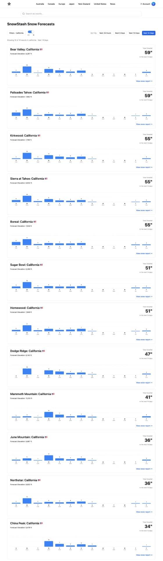
Projected Snowfall Totals
Forecasters emphasise significant model disagreement across the industry. Of the 14-15 models tracked by OpenSnow's Tahoe forecaster, eight show 3-4 inches of liquid precipitation near the crest for the Wednesday-Friday period, while six show 5-7 inches. This variance translates to potentially 1-1.5 feet difference in final snow totals.
The Tahoe forecast specifically warns against believing projections of 5+ feet, noting these are based on the wettest models while ignoring more conservative European model data showing only 26 inches along the crest.
Tahoe Region Resorts
Kirkwood leads all projections at 56-100 inches according to SnowBrains, with OpenSnow showing consistent 19-22 inch days Wednesday through Friday. Their 8,215-foot elevation puts them above problematic snow levels even during the weekend atmospheric river, and their location often captures more precipitation than resorts closer to the lake.
Palisades Tahoe projects 38-69 inches total, with Tahoe forecasters showing 1.5-3 feet at their base and 2.5-4.5 feet on upper mountains by Saturday morning.
Sugar Bowl shows 40-72 inches total. Their higher elevation (7,461 feet base) positions them well for the midweek storm since snow levels will be comfortably below their base by Wednesday. Currently temporarily closed, but this snow should enable a Christmas opening.
Heavenly projects 21-40 inches, with most arriving Tuesday night onwards. OpenSnow shows steady 8-10 inch days Wednesday through Friday. The southerly flow could work against Heavenly since they're positioned right at the lake, though their California-side terrain should perform better than Nevada-side runs.
Northstar is looking at 24-45 inches, with the bulk arriving Tuesday night through Saturday. OpenSnow shows consistent 11-12 inch days Thursday through Saturday. At 7,487 feet elevation and only 3% currently open, this snow is desperately needed.
Bear Valley (8,340 feet) projects 43-81 inches total. Currently temporarily closed, but this snow should enable a Christmas opening. Their elevation puts them in a similar favourable position as Kirkwood.
Eastern Sierra Resorts
Mammoth Mountain sits at 44-81 inches according to SnowBrains, with the Mammoth forecaster predicting 22-38 inches just from Tuesday night through Christmas morning at Main Lodge (9,000+ feet base), with the summit potentially exceeding 3 feet. Wednesday through Friday shows projected daily totals of 21-22 inches.
June Mountain shows 25 inches near-term and 45 inches extended, with Wednesday and Thursday projected at 22 and 19 inches respectively. At only 2% open currently, this represents a complete transformation for the resort.
Currently Closed Resorts
Several currently closed resorts are looking at enough snow to potentially open for the holiday period:
- Sierra-at-Tahoe (7,779 feet): 27 inches near-term, 43 inches extended
- Donner Ski Ranch (7,044 feet): 23 inches near-term, 45 inches extended
- Boreal (7,310 feet): 34 inches near-term, 45 inches extended
- Tahoe Donner (7,133 feet): 22 inches near-term, 38 inches extended
- China Peak (8,071 feet): 17 inches near-term, 58 inches extended
The challenge for these resorts is that much of this snow falls on bare or nearly bare ground. Forecasters note ski areas will need several days to build trails and complete grooming before opening new terrain.
Wind Impacts and Operational Challenges
Both Tahoe and Mammoth forecasters are explicit about wind impacts throughout the storm cycle. Ridge-top winds start building Saturday evening to 80-100+ mph through Sunday and Monday, staying at 70-80+ mph over exposed ridges Monday through Thursday as the Christmas storms move through.
The Mammoth forecaster notes: "You can definitely expect between heavy snowfall, high winds, and whiteout conditions, that upper mountain lifts will likely remain closed through Thursday."
This is the reality of powerful Pacific storms. Significant snow is arriving, but skiers won't necessarily access the best terrain while it's falling. The winds don't fully drop until the end of the week—Friday looks like the first day where upper mountain lifts might run more consistently.
For terrain parks and beginner areas at lower elevations, operations should be less impacted. But anyone planning to chase steep upper mountain terrain Christmas Eve or Christmas Day should prepare for closures and adjust expectations accordingly.
The positive side: these same strong winds will help with snowmaking operations. Forecasters note that colder air behind the storms will allow for snowmaking later in the week, helping resorts open additional terrain.
Post-Christmas Outlook
What makes this forecast particularly significant is what happens after the Christmas storms clear. Long-range models show high pressure building in quickly for the weekend of 27-28 December, creating potentially ideal conditions.
The storms dump substantial snow Tuesday through Friday, winds finally decrease Friday into Saturday, and then high pressure moves in for the weekend. Forecasters note this "should bring a nice and likely busy weekend of skiing" with ski areas having had time to open terrain and make additional snow where needed.
Temperatures during this post-Christmas high-pressure window drop into the 30s for lower elevations and 20s for upper mountains—cold enough for quality snow preservation and snowmaking, but not brutally cold for skiing.
This isn't the end of the active pattern. The broader weather signal supports above-normal precipitation across California into early January. The 11-15 day OpenSnow forecasts show resorts like Kirkwood (28 inches), Palisades (29 inches), and Sierra-at-Tahoe (30 inches) continuing to receive snow well into the new year. Mammoth shows 17 inches in that same extended window.
This represents a genuine pattern shift from the dry, stagnant conditions that dominated November and early December, moving from a ridge-dominated pattern that kept storms away to a more active Pacific jet stream delivering regular systems to California.
Practical Implications for Holiday Travel
If you have Christmas holiday plans at California resorts, this forecast changes the calculation significantly. Resorts that looked questionable even a week ago now have realistic chances of meaningful terrain offerings.
The Wednesday-Friday period will deliver the best snow quality, but also the most challenging travel conditions. Highway 50 to South Lake Tahoe, Interstate 80 through the Sierra, and Highway 395 to the Eastern Sierra will all see periods of difficult driving and potential closures for avalanche control.
An interesting development: the Mammoth forecaster notes the European model has been trending to push the weekend atmospheric river further north over recent runs. If that trend continues, Mammoth could miss much of the weekend rain while Tahoe gets "absolutely clobbered." This could leave Mammoth in better shape going into the midweek storms since they won't have rain damage to their existing snowpack.
For resorts currently closed, monitoring their websites and social media for opening announcements will be critical. Sugar Bowl, Bear Valley, Boreal, and potentially some smaller areas could announce Christmas week openings as this snow accumulates.
One critical note from forecasters: "The ski areas will need a couple of days to build the trails, as a lot of this snow is falling on bare ground, so have patience with terrain expansion through the end of the week." Don't expect every lift running by Christmas morning—give resorts time for snowmaking, grooming, and avalanche control work before opening new terrain.
After watching California resorts struggle through one of the slowest November and early December periods in recent memory, this forecast represents exactly the turnaround the industry needed. The timing isn't perfect—weekend snow will be heavy and dense with high snow levels creating more rain than powder at many base elevations. But the midweek cooling and Christmas period snow should deliver legitimate powder conditions right when resorts are packed with holiday visitors.
For anyone who's been watching the forecasts with growing concern, this is the system that changes the narrative. California's Christmas gift isn't just snow—it's the pattern shift that suggests this winter might finally get going.