
Mountain High
290 acres across 3 mountains, 59 runs, night skiing 7 nights weekly. Just 90 minutes from LA in California's San Gabriel Mountains.
Season 2026 - 2027
Opens
28 Nov 2026
Closes
15 Mar 2027
Days open
107
Annual snow
10ft
The Overview
Michael Fulton
Melbourne-based skier and snowboarder with 50+ resorts across 5 continents. Specialises in Australian resorts and international resort comparisons.
Mountain High operates across 290 acres in the San Gabriel Mountains, spanning elevations from 2012 to 2499 metres with 487 metres of vertical drop. The resort comprises 59 runs across three distinct areas – East, West, and North – with terrain split 25 percent beginner, 40 percent intermediate, 30 percent advanced, and 5 percent expert. Goldrush, the 2.6-kilometre run at East Resort, holds the distinction of being Southern California's longest trail. Snowmaking covers more than 80 percent of terrain, supplementing an annual average of 3 metres of natural snowfall, whilst the resort claims consistent early-season opening as the first Southern California area to operate each winter.
West Resort dominates with terrain parks featuring obstacles like the Slayer Box and Paradox, plus The Reef glade zone when snow depth allows. East Resort delivers a contrasting alpine character with long groomed runs, Olympic Bowl mogul field, and sweeping views across the Mojave Desert. North Resort, formerly Ski Sunrise, offers 70 acres of beginner-intermediate terrain and Southern California's largest tubing park with up to 12 lanes, operating Fridays through Sundays during peak season. The Discovery Chairlift at East Resort summit provides access to 20 acres of beginner terrain at 2499 metres elevation.
Night skiing operates seven nights weekly during peak season until 10pm, primarily at West Resort with more than 85 percent of terrain illuminated. Free shuttles run every five to ten minutes between East and West bases, with single tickets valid across all three mountains. The Bullwheel Bar and Grill anchors West Resort's lively base scene with live music and events, whilst Grand View Bistro at East summit serves sit-down dining at 2499 metres. Wrightwood, 5 kilometres east, provides overnight accommodation from budget cabins to multi-bedroom rentals, though the resort itself offers no lodging.
Mountain High participates in the Powder Alliance, granting passholders three free days at 14 partner resorts worldwide. The Cali Pass delivers unlimited access here plus Bear Valley, Dodge Ridge, and China Peak. Season passes start at $399 USD, with daily tickets ranging $69-89 USD depending on date, whilst night sessions run $45-55 USD. The resort suits Los Angeles day-trippers seeking accessible terrain variety, terrain park riders drawn to West Resort's features, and families attracted to North Resort's dedicated learning zones and California's value-driven pricing structure.
1,598ft
Vertical
59
Runs
290 acres
Skiable
10ft
Annual snow
Powder Alliance
Pass
The Terrain
59 runs across 290 acres skiable
Mountain High covers about 290 acres (117 hectares) of the San Gabriel Mountains above Wrightwood, spread over East, West and North areas with 59 runs between them. The base sits near 6,600 ft (2,012 m) and the top reaches 8,200 ft (2,499 m), a vertical of 1,600 ft (487 m). Intermediates take 40% of the terrain, advanced runs 30%, beginners 25% and experts 5%. It is a compact mountain by Sierra standards, though the mix of quads, doubles, triples and surface lifts keeps laps quick and queues manageable on most days.
East Resort holds Goldrush, a 1.6-mile run billed as the longest in Southern California, plus the double black Olympic Bowl, the mountain's best mogul field. West Resort leans toward terrain parks and lit night sessions, while North Resort is mostly gentle slopes for first-timers. Expert skiers will run out of challenge within a day, because steep pitches are limited. Mountain High suits Los Angeles day-trippers, families starting out and park riders after a quick session, with enough cruising variety to keep intermediates entertained across all three areas.
Terrain split
59
runs
59 runs across 4 grades
Beginner15 runs · 25%
Intermediate24 runs · 40%
Advanced18 runs · 30%
Expert3 runs · 5%
Time it right
When to visit Mountain High
Mountain High operates from late November through mid-March, with the 2025-26 season running 28 November 2025 to 15 March 2026. West Resort typically opens first in Southern California due to higher base elevation at 2133 metres and extensive snowmaking infrastructure, often operating before Thanksgiving. The season spans approximately 108 days, shorter than northern counterparts but reliable given comprehensive snowmaking coverage. Night skiing runs Wednesday through Sunday during peak periods, extending operational hours seven nights weekly when conditions allow.
The resort receives an average 3 metres of natural snowfall annually, with February historically delivering peak accumulation around week four of the month averaging 12 centimetres per snowfall event. Snowmaking covers more than 80 percent of terrain, enabling operations despite Southern California's Mediterranean climate and lower natural snow totals compared to Sierra Nevada resorts. The 2025-26 season recorded 112 centimetres of total snowfall by March. Elevation advantage at East and West summits approaching 2500 metres helps retain snow quality, whilst North Resort's reliance on natural snow limits operational days.
January through February offers optimal powder conditions following storm cycles tracking across Southern California, whilst March delivers spring corn snow and warmer temperatures. Weekday visits avoid weekend crowds that swell from Los Angeles and Orange County, with Thursday attracting locals for fresh snow before weekend tracking. December holiday periods from 20 December through 4 January rank as busiest, alongside Martin Luther King weekend and Presidents' Day weekend mid-February. Early-season November conditions depend entirely on snowmaking, with natural terrain limited until late December.
Oktoberfest runs weekends 4-19 October at West Resort, attracting thousands annually as Wrightwood's largest festival. Terrain park competitions including rail jams and freestyle events punctuate the calendar, whilst family programming features Easter egg hunts hiding $5,000 in prizes and discounts. The H2O Winter Surf/Snow Classic and various USASA sanctioned events draw competitive riders. Summer operations include disc golf on three nine-hole courses at North Resort, plus camping, events, and seasonal festivals, though mountain biking has paused as of 2026.
Season 2026 - 2027
28 Nov 2026
Opens
15 Mar 2027
Closes
107
Days open
10 ft
Annual snow
Getting there
Getting to Mountain High, and where to stay
Mountain High sits in the San Gabriel Mountains within Angeles National Forest in Los Angeles County, California, despite proximity to the San Bernardino County line near Wrightwood. The three resort areas stretch along State Route 2 west of Wrightwood township, with base elevations ranging 2012-2194 metres and summit reaching 2499 metres at East Resort. The San Gabriel range forms a dramatic transition between the Los Angeles Basin to the south and the Mojave Desert stretching north and east, with resort terrain offering desert vistas rare for ski areas.
Wrightwood, population 4,525, sits 5 kilometres east at 1809 metres elevation, providing the nearest services, dining, and overnight lodging for visitors. The mountain town operates year-round as a recreation gateway, with the resort located along State Route 2 approximately 5 kilometres past Wrightwood when approaching from Highway 138. Los Angeles lies 145 kilometres southwest, whilst San Diego sits 3.5 hours south via Interstate 15. Orange County communities including Anaheim reach the resort in 75 minutes. The Antelope Valley cities of Palmdale and Lancaster lie close enough that West Resort's night lighting remains visible from the desert floor.
State Route 2, known as Angeles Crest Highway through this section, provides primary access from Los Angeles via Interstate 210 in La Cañada Flintridge, climbing 66 kilometres through the San Gabriel Mountains with no mountain driving chains required under normal conditions. From the Inland Empire and desert approaches, Interstate 15 North to Highway 138 West connects to State Route 2, delivering visitors in 90 minutes from downtown Los Angeles. The Highway 138 junction sits 20 minutes from Interstate 15. No petrol stations operate along the 90-kilometre stretch between La Cañada and Wrightwood.
Ontario International Airport lies 63 kilometres south, requiring approximately 45 minutes driving time, making it the closest commercial service. Los Angeles International Airport sits 90 minutes southwest, whilst John Wayne Airport in Orange County and Hollywood Burbank Airport both fall within 90-minute range. Rally shuttle service operates regular runs from Los Angeles area, whilst most visitors drive personal vehicles. No rail service reaches Wrightwood, and public transport options from airports require multiple transfers exceeding five hours, making rental cars or shuttles essential for airport arrivals.
Where to stay
Search all stays →Hotels and lodges near Mountain High, powered by Stay22.
Latest News
From the SnowStash desk
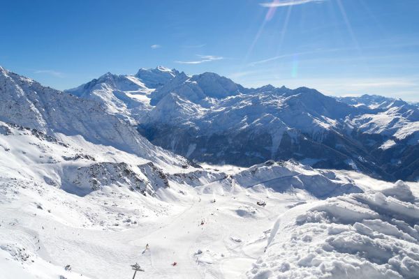
Alps Snow Forecast: Up to 64 cm Headed for the High Glaciers as the Snow Line Drops
The Alps are about to swap mild, sunny October weather for something far more wintry. A cold front arrives Tuesday, and SnowStash forecasts have Monterosa Ski out in front with 64 cm over 14 days, ahead of Blatten Belalp (55 cm) and Verbier (43 cm). The snow line should fall below 2000 metres by Wednesday night, and glaciers across Switzerland, Italy and Austria are in line for the best of it. The wind will have a say too.
20 Oct 2026
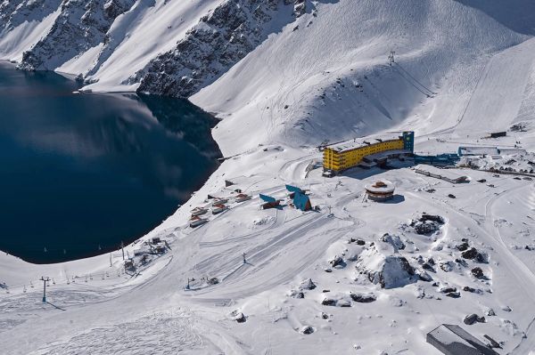
Four Dead After Avalanche Near Ski Portillo in Chile
A large avalanche struck near Laguna del Inca adjacent to Ski Portillo on Saturday afternoon, killing four people and injuring four others. The group were day visitors mountaineering in the backcountry after reportedly being warned about elevated avalanche risk by resort staff.
18 Oct 2026

Europe Ski Resorts Open Now: What Is Skiable in Mid-October 2026
Europe’s ski season is open, technically. After a record-warm summer, glaciers in Austria, Switzerland and Italy are running a few pistes apiece, Sölden, Stubai and Kitzsteinhorn started late, Titlis has pushed back to 24 October, and Zermatt reopens a few lifts on 14 October after more than two months shut. Finland’s Levi and Ruka are skiing on stored snow. Here is what is open, and what you actually get at each.
14 Oct 2026

Zermatt Plans World Cup Downhill Return on the Gornergrat for 2028
Zermatt is having another crack at a World Cup downhill, and this time nobody has to cross a border. Around 13 million Swiss francs is going into rebuilding the Gornergrat piste, including a jump fed by a roughly 300-metre in-run across the roof of the Gornergrat Railway gallery, with the Matterhorn lined up behind it for the TV cameras. First men’s race is pencilled in for March 2028, pending FIS homologation.
14 Oct 2026

Mt. Rose Begins Snowmaking for the 2026-27 Season at Lake Tahoe
Lake Tahoe’s highest base elevation is paying off early: Mt. Rose has started making snow for 2026-27 after the first flurries and a cold snap. The Nevada resort is backing it with nearly US$2 million in upgrades, including a replacement snowmaking main line, a new PistenBully groomer and restraint bars on every lift. Opening day is yet to be confirmed, though Heavenly and Northstar are already eyeing 20 November.
13 Oct 2026

Utah Ski Resorts 2026-27: What’s New at Alta, Deer Valley, Powder Mountain and More
Utah is still building flat out. For 2026-27, Powder Mountain opens a steep new Skytrac chair into more than 1,000 acres of advanced terrain, Deer Valley adds 200 acres on Hail Peak, Sundance gets a new quad and Park City adds a gondola from its new parking structure. Snowmaking is expanding almost everywhere, Eagle Point stays closed after the Cottonwood Fire, and the 2034 Games are setting the pace. Here’s what’s new, resort by resort.
13 Oct 2026

Mt Hutt Invests NZ$12 Million in Base Area, Tripling Its Sun Deck
Mt Hutt is getting busier, and its base lodge is about to catch up. NZ$12 million goes into a heated sun deck roughly three times the current size (430 m² to 1,300 m²), plus a new toilet block, heated steps down to snow level, extra storage and a new food and beverage outlet. Building starts after the 2026 season, with everything due for winter 2027.
11 Oct 2026

Vermont Ski Resort Opening Dates 2026-27: Few Dates Set, Killington Waits on the Cold
Vermont's season is slow to take shape. Stratton is tentatively targeting 18 November and Sugarbush 21 November, while Pico has Friday 11 December on the calendar. Killington never sets a date and opens when the snowmaking allows, and Vail Resorts has yet to name days for Stowe, Okemo and Mount Snow. The forecasts disagree about snow, and the main El Niño worry for the Green Mountains is warmth.
9 Oct 2026
Mountain High Webcams
5 live angles across the mountain. Tap any camera to go full-screen.
About Mountain High's live webcams
Check live conditions across Mountain High with 5 real-time webcams showing snow, weather, and lift operations, updated every 10 minutes. Check high-elevation cams for powder visibility and base-area cams for crowd levels before you head up.
Camera guide
- East Summit8,199ft
- The Mountain High webcam at East Summit delivers stunning panoramic views from SoCal's highest ski terrain at 2499 meters elevation. This mountain high live cam offers a unique perspective of both the resort's advanced runs and the sweeping Mojave Desert landscape below. Essential for checking summit conditions and visibility, this live snow cam showcases the dramatic high-altitude skiing just 90 minutes from Los Angeles.
- Yeti's Snowplay6,598ft
- One of Mountain High ski resort's most popular live cams, this feed showcases the family-friendly snow play area at 2011 meters where winter fun comes alive. Watch visitors enjoy the tubing runs and beginner terrain through this Mountain High webcam focused on this dedicated learning zone. This live snow cam captures the welcoming atmosphere that makes this Southern California's premier family destination.
- WSC Bullwheel6,998ft
- Part of Mountain High's network of webcams, this vantage point from the West Resort's upper terminal at 2133 meters captures real-time views of the resort's most popular runs and terrain park features. The mountain high live cam stream keeps you connected to current conditions and park activity. This Mountain High web cam provides essential visibility across the diverse terrain zones.
- Borderline8,199ft
- The Mountain High ski resort webcam at Borderline provides an eagle-eye view of advanced terrain from the summit at 2499 meters. This strategic camera placement gives visitors a clear look at upper mountain conditions and the majestic San Gabriel range through this live snow cam. Monitor visibility and snow quality before tackling challenging slopes at this high-elevation SoCal destination.
- West Base6,998ft
- Monitor current conditions through this Mountain High webcam positioned at the West Resort's main base area at 2133 meters. This essential mountain high live cam feed shows real-time lift operations and base area activity, perfect for planning your visit to SoCal's premier winter destination. The live snow cam delivers crucial information about crowds and weather before you make the drive up from Southern California.
Mountain High snow cams FAQ
How often do Mountain High snow cams update?
All Mountain High snow cams and webcams update every 10 minutes with fresh images showing current mountain conditions. This frequent update schedule ensures you have access to near real-time conditions for planning your ski day at Mountain High.
Which Mountain High webcam shows the best powder conditions?
The high-elevation East Summit webcam at 2,499m provides the clearest view of powder conditions and snowfall. These Mountain High webcams capture fresh snow accumulation and visibility better than base area cameras.
Can I see Mountain High lift queues on the webcams?
Yes. Multiple Mountain High snow cams specifically show lift queue areas and chairlift operations, helping you time your arrival and avoid peak queue periods.
When is the best time to check Mountain High snow cams?
Check Mountain High webcams early morning (7-8am) for overnight snowfall assessment, and mid-afternoon for current crowd levels and weather. The live cams are most useful after storm events to assess fresh powder.
How can I check current conditions before buying Mountain High lift tickets?
Use our Mountain High webcams alongside the live snow report to assess conditions before purchasing lift tickets. The webcams show real-time visibility, snow quality, and operational status.
Do Mountain High webcams work on mobile devices?
Yes. All Mountain High snow cams and webcams are optimized for mobile viewing, so you can check live conditions from anywhere using your phone or tablet.
More Mountain High intelligence: snow report, lift tickets, trail map, resort overview.