
Deer Valley
2,026 acres, 103 runs, 3,000 ft vertical. Utah's skiers-only resort with 300 inches annual snowfall and Ikon Pass access.
Season 2026 - 2027
Opens
5 Dec 2026
Closes
28 Mar 2027
Days open
113
Annual snow
25ft
The Overview
Michael Fulton
Melbourne-based skier and snowboarder with 50+ resorts across 5 continents. Specialises in Australian resorts and international resort comparisons.
Deer Valley operates across 2,026 acres with 103 runs spanning elevations from 6,570 to 9,570 feet, delivering 3,000 feet of vertical drop. The Utah resort averages 300 inches of snowfall annually and maintains a skiers-only policy, excluding snowboarders entirely. Terrain splits 27 per cent beginner, 41 per cent intermediate and 32 per cent advanced and expert across six mountains including Bald Mountain, Flagstaff Mountain and Empire Canyon.
Signature runs include Mayflower Bowl for advanced skiers, the 2-mile Jordanelle cruiser and groomed blues like Stein's Way and Perseverance. The resort maintains limited daily capacity and requires reservations for Ikon Pass holders, ensuring uncrowded conditions. Empire Canyon Bowl and Lady Morgan Bowl offer 930 acres of glades and chutes for expert terrain, whilst three bowls provide powder access following storms.
Deer Valley's atmosphere centres on meticulous grooming, complimentary ski valet service at base lodges and upscale on-mountain dining including the famed turkey chilli. Snow Park Lodge, Silver Lake Lodge and Empire Pass provide the primary base facilities. The resort hosted freestyle and mogul events during the 2002 Winter Olympics and consistently ranks among North America's top resorts for service quality.
Ikon Pass provides up to seven days access with mandatory advance reservations, whilst Deer Valley's Unlimited Pass costs $3,299 for unrestricted season access. A major expansion added three chairlifts and 300 acres at the new East Village base during the 2024-25 season, with 2,000 additional acres planned by 2026-27. The resort suits intermediate cruisers, families seeking crowd control and skiers prioritising grooming over extreme terrain.
3,002ft
Vertical
103
Runs
2,026 acres
Skiable
25ft
Annual snow
Ikon
Pass
The Terrain
103 runs across 2,026 acres skiable
Deer Valley is a skiers-only resort above Park City, Utah, covering 2,026 acres (820 hectares) across 103 runs. The base sits at 6,570 ft (2,002 m) and the top of the lifts at 9,570 ft (2,917 m), a clean 3,000 ft (915 m) of vertical. The split is 27% beginner, 31% intermediate, 10% advanced and 32% expert, an unusual shape with plenty of easy cruising and a large block of steep terrain but little in between. Terrain is spread over several peaks, including Bald Mountain, Flagstaff Mountain and Empire Canyon, and daily lift ticket sales are capped to keep the slopes uncrowded.
Mayflower Bowl is a signature run for advanced skiers on a powder day, and Lady Morgan Bowl adds glades and chutes for expert terrain. Empire Canyon is another draw for advanced skiers, with steep chutes and challenging lines. Groomed blues such as Stein's Way and Perseverance suit intermediates who want long, smooth laps, and Bald Mountain holds Jordanelle, a run of about 4.9 miles down to the Jordanelle Gondola base. The newer East Village base added three chairlifts and 300 acres in the 2024-25 season, with more terrain planned. Deer Valley suits intermediates who love smooth corduroy, families wanting calm slopes, and advanced skiers after glades without the crowds.
Terrain split
103
runs
103 runs across 4 grades
Beginner28 runs · 27%
Intermediate32 runs · 31%
Advanced10 runs · 10%
Expert33 runs · 32%
Time it right
When to visit Deer Valley
The 2025-26 season opened 6 December 2025 with closure scheduled for 29 March 2026, spanning approximately 114 days. Early-season operations began with Carpenter Express, Sterling Express and Homestake Express serving three groomed runs from Snow Park Lodge. Deer Valley typically operates mid-December through early April, with the 2024-25 season closing 27 March following below-average snowfall.
Annual snowfall averages 300 inches, with the resort's 6,570 to 9,570-foot elevation range providing reliable coverage through mid-winter. Snowmaking infrastructure covers 886 acres across priority terrain, ensuring consistent early-season conditions. Peak snowfall occurs January through February, with January's second week historically delivering the heaviest accumulation cycles.
Optimal timing targets January and February for powder conditions, whilst March offers spring corn snow on warmer afternoons and fewer holiday crowds. December and early January see limited terrain availability as snowmaking ramps up. Midweek skiing from late January through February provides the best powder-to-crowd ratio before the Presidents' Day holiday rush.
The resort celebrates its 45th anniversary during 2025-26 with expanded terrain access throughout the season. No night skiing operates at Deer Valley. Season pass holders receive First Tracks access 30 minutes before public opening on select dates announced each autumn, whilst Ikon Pass holders access three designated First Tracks days per season.
Season 2026 - 2027
5 Dec 2026
Opens
28 Mar 2027
Closes
113
Days open
25 ft
Annual snow
Getting there
Getting to Deer Valley, and where to stay
Deer Valley sits in the Wasatch Range immediately east of Park City, Utah, with its Snow Park Lodge base at 6,570 feet elevation. The resort occupies the slopes of Flagstaff Mountain and Empire Canyon in Summit County, 1.5 miles from Park City's historic Main Street. Six mountains comprise the ski area, extending from Park City's eastern boundary into previously undeveloped terrain now accessed via the East Village portal.
Park City lies 31 miles east of Salt Lake City and serves as the primary base town, offering restaurants, lodging and the free citywide transit system connecting Deer Valley's base areas. The mountain resort village of Park City was founded as a silver mining boomtown in the 1860s and hosted events during the 2002 Winter Olympics. Empire Pass represents Deer Valley's exclusive upper-mountain residential area with ski-in, ski-out access near the Silver Strike Express chairlift.
Salt Lake City International Airport sits 38 miles northwest via Interstate 80 east to exit 145, then Utah State Route 224 south into Park City. Drive time requires 40 to 60 minutes depending on traffic and weather conditions. The route follows well-maintained highways with frequent winter ploughing, though four-wheel drive benefits upper Park City access during storms.
Heber Valley Airport provides private aircraft access 20 minutes south, accommodating corporate jets on its single runway. Provo Airport offers limited commercial service 45 minutes south via US Route 40. No rail service reaches Park City, though Amtrak serves Salt Lake City with connections requiring ground transfers. Shared shuttle services, ride-share options and rental cars operate from Salt Lake City International, with the Richardson Flat park-and-ride offering free buses to Snow Park Lodge during peak periods.
Where to stay
Search all stays →Hotels and lodges near Deer Valley, powered by Stay22.
Latest News
From the SnowStash desk

Europe Ski Resorts Open Now: What Is Skiable in Mid-October 2026
Europe’s ski season is open, technically. After a record-warm summer, glaciers in Austria, Switzerland and Italy are running a few pistes apiece, Sölden, Stubai and Kitzsteinhorn started late, Titlis has pushed back to 24 October, and Zermatt reopens a few lifts on 14 October after more than two months shut. Finland’s Levi and Ruka are skiing on stored snow. Here is what is open, and what you actually get at each.
14 Oct 2026

Zermatt Plans World Cup Downhill Return on the Gornergrat for 2028
Zermatt is having another crack at a World Cup downhill, and this time nobody has to cross a border. Around 13 million Swiss francs is going into rebuilding the Gornergrat piste, including a jump fed by a roughly 300-metre in-run across the roof of the Gornergrat Railway gallery, with the Matterhorn lined up behind it for the TV cameras. First men’s race is pencilled in for March 2028, pending FIS homologation.
14 Oct 2026

Mt. Rose Begins Snowmaking for the 2026-27 Season at Lake Tahoe
Lake Tahoe’s highest base elevation is paying off early: Mt. Rose has started making snow for 2026-27 after the first flurries and a cold snap. The Nevada resort is backing it with nearly US$2 million in upgrades, including a replacement snowmaking main line, a new PistenBully groomer and restraint bars on every lift. Opening day is yet to be confirmed, though Heavenly and Northstar are already eyeing 20 November.
13 Oct 2026

Utah Ski Resorts 2026-27: What’s New at Alta, Deer Valley, Powder Mountain and More
Utah is still building flat out. For 2026-27, Powder Mountain opens a steep new Skytrac chair into more than 1,000 acres of advanced terrain, Deer Valley adds 200 acres on Hail Peak, Sundance gets a new quad and Park City adds a gondola from its new parking structure. Snowmaking is expanding almost everywhere, Eagle Point stays closed after the Cottonwood Fire, and the 2034 Games are setting the pace. Here’s what’s new, resort by resort.
13 Oct 2026

Mt Hutt Invests NZ$12 Million in Base Area, Tripling Its Sun Deck
Mt Hutt is getting busier, and its base lodge is about to catch up. NZ$12 million goes into a heated sun deck roughly three times the current size (430 m² to 1,300 m²), plus a new toilet block, heated steps down to snow level, extra storage and a new food and beverage outlet. Building starts after the 2026 season, with everything due for winter 2027.
11 Oct 2026

Vermont Ski Resort Opening Dates 2026-27: Few Dates Set, Killington Waits on the Cold
Vermont's season is slow to take shape. Stratton is tentatively targeting 18 November and Sugarbush 21 November, while Pico has Friday 11 December on the calendar. Killington never sets a date and opens when the snowmaking allows, and Vail Resorts has yet to name days for Stowe, Okemo and Mount Snow. The forecasts disagree about snow, and the main El Niño worry for the Green Mountains is warmth.
9 Oct 2026
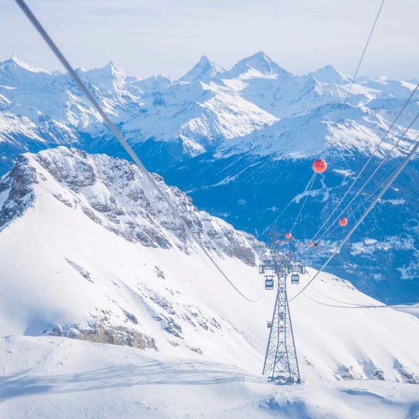
Crans-Montana 2027 World Championships President Resigns Ahead of Fraud Hearing
Less than four months out from the Crans-Montana 2027 World Championships, the man running the organising committee has stepped down. Claude-Alain Schmidhalter resigned as Swiss-Ski vice president and OC president after being indicted over a business dispute unrelated to skiing. He denies the allegations and faces court on October 27. Interim leaders are in place for the February 1-14 event.
9 Oct 2026
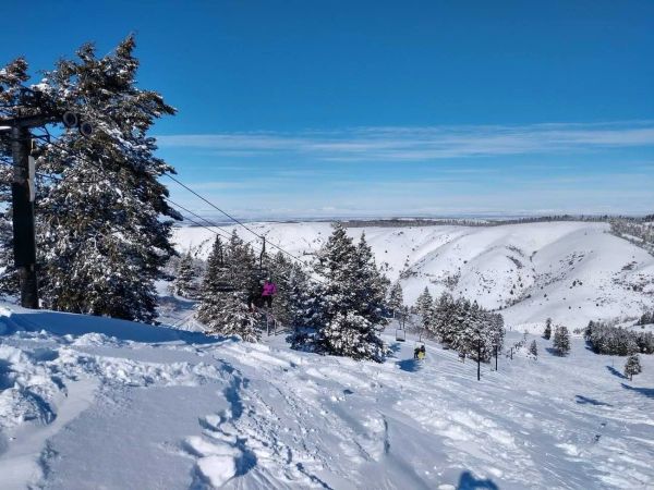
Kelly Canyon, Idaho, Adds Snowmaking, a Bigger Terrain Park and More Parking for 2026-27
Kelly Canyon had a rough 2025-26, and the Idaho resort has spent the summer making sure it doesn’t repeat. Snowmaking now reaches the top of Goldrush, the terrain park is doubling in size with a stereo system, lights and a snack shack, and the car park is getting bigger. Grooming is stepping up too. Target opening is December 4, conditions permitting.
9 Oct 2026
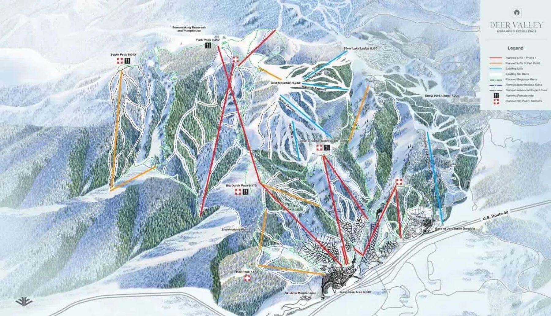
Deer Valley Trail Map
Downloadable Deer Valley trail map
Terrain split
103
runs
Beginner27%
Intermediate31%
Advanced10%
Expert32%
2,026 acres skiable820 hectares
Resort Stats
Elevation
Base6,568ft
Summit9,570ft
Annual snowfall
25ft
Season
2026 - 2027
5 Dec 2026 - 28 Mar 2027
Trail coverage
103 runs
2,026 acres (820 ha)
About Deer Valley's trail map
Explore Deer Valley's full trail map with 103 runs across the mountain, colour-coded by difficulty and shown alongside the terrain split. Use it to plan a day that matches your ability, find lift-served pockets of your favourite grade, and see how the resort links together. Download the piste map (PDF) ↗
More Deer Valley intelligence: snow report, lift system, webcams, resort overview.