
New Zealand Ski Resorts Anticipate Major Snowfall: Up to 4 Feet Expected
Published Date:

Melbourne-based skier and snowboarder with 50+ resorts across 5 continents. Specialises in Australian resorts and international resort comparisons.

New Zealand Ski Resorts Prepare for Substantial Early-Season Snowfall
New Zealand's ski resorts are gearing up for a significant early-season snowfall event. Weather forecasts indicate that up to 4 feet of snow could blanket the Southern Alps this week, providing a solid foundation for the upcoming ski season. This snowfall is particularly timely as many resorts plan to open their lifts later this month.
The snow is expected to arrive in two distinct waves. The first system will bring dense, wet snow that will help create a stable base layer. Following this, a colder system will deliver lighter, drier snow, ideal for creating optimal skiing conditions.
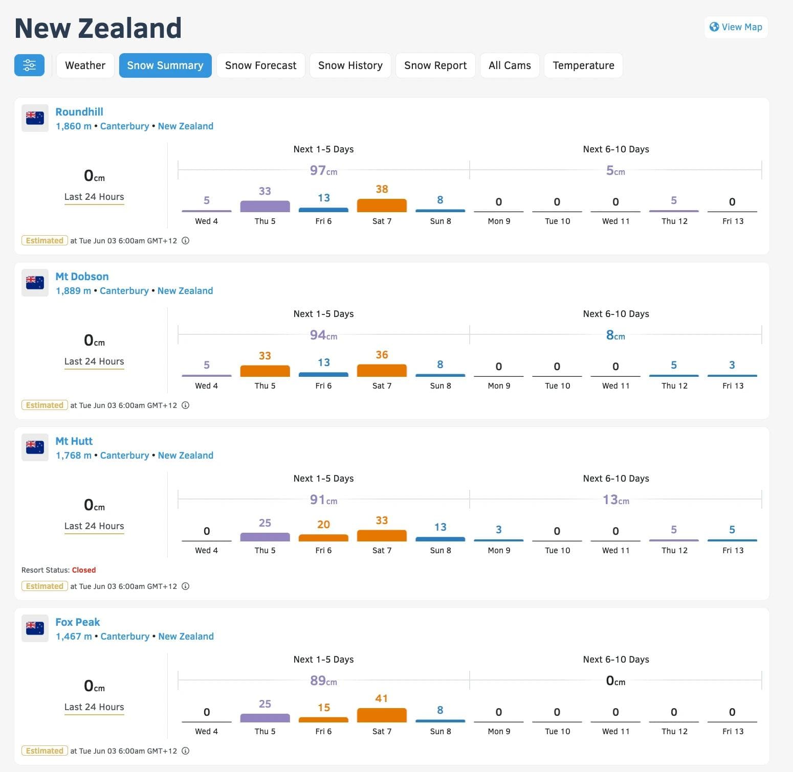
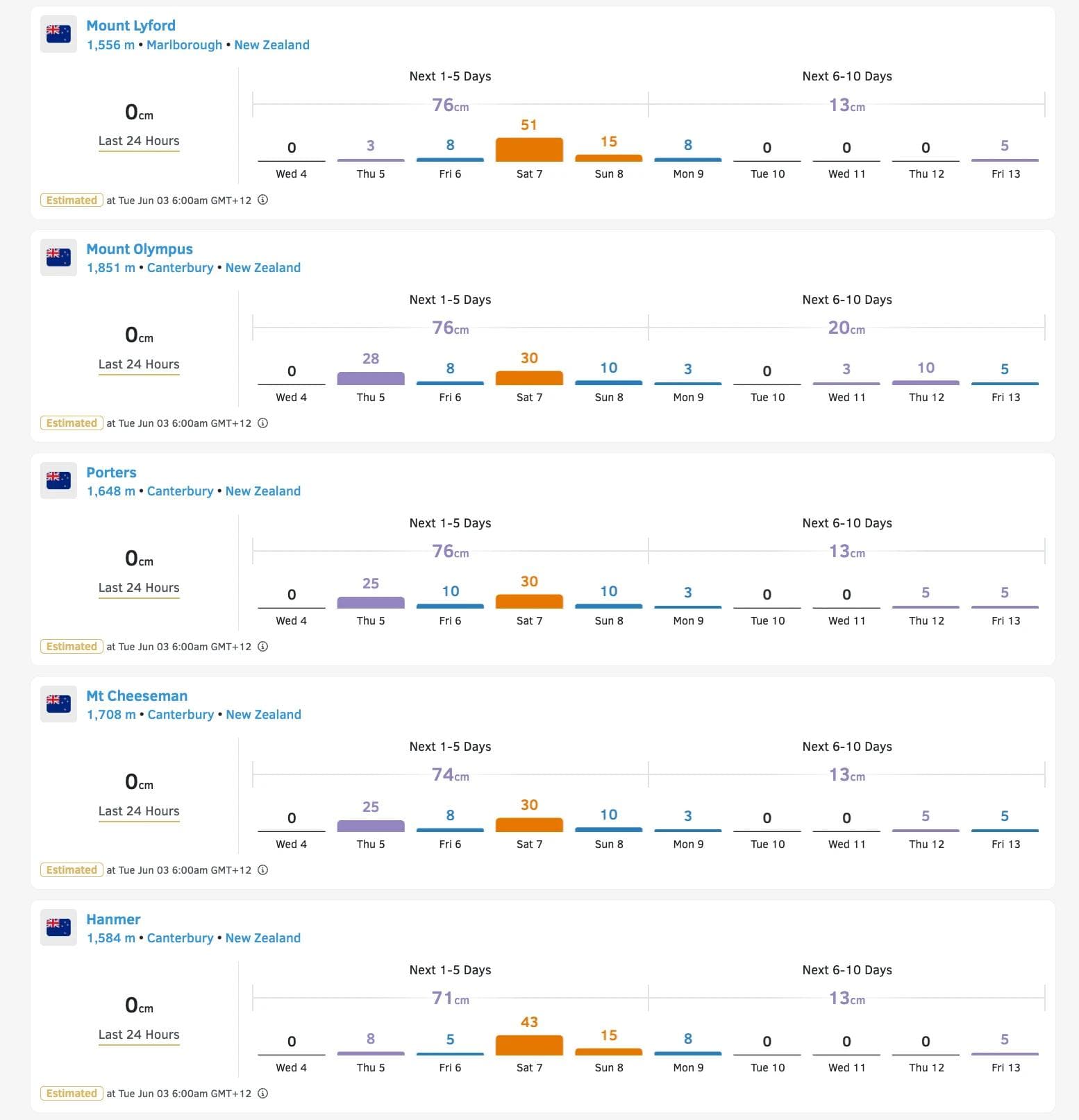
The initial snowfall is predicted to begin on Wednesday night, with snow levels around 3,500 feet. This ensures that the majority of ski resort base areas will receive snow. Resorts such as Mt Hutt, Porters, and Mount Dobson in the Canterbury region are expected to receive 8 to 12 inches of snow with this first system.
The second wave of snow is forecast to arrive late Thursday night and continue through Monday. This system will bring colder temperatures, lowering snow levels to as low as 700 feet by Saturday. The Canterbury region is again expected to benefit the most, with an additional 14 to 30 inches of lighter powder snow possible. By Monday, many resorts in this area could have a base depth exceeding 30 inches.
While the Queenstown and Wānaka regions are expected to receive less snow, resorts like Treble Cone, Cardrona, The Remarkables, and Coronet Peak are still forecast to accumulate 5 to 9 inches of snow. This will provide a good starting point for their base layers.
Further north, Mount Ruapehu's ski areas, Tūroa and Whakapapa, are also set to benefit from this weather system. These resorts could see 6 to 11 inches of new snow, which will help consolidate the existing snowpack on the volcanic terrain.
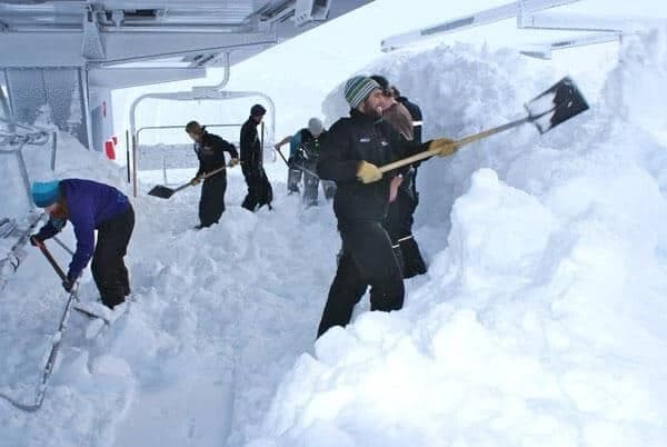
This early-season snowfall is crucial for New Zealand's ski resorts. It allows them to establish a solid base layer, which is essential for a successful and prolonged ski season. Resort staff will use this opportunity to begin trail preparation and assess conditions ahead of their official openings. Skiers and riders in New Zealand and those planning to visit can look forward to promising early-season conditions.